The network for creativity
Join 1.25M professional creatives like you
Connect with clients, get discovered, and run your business 100% commission-free
Creatives on Contra have earned over $150M and we are just getting started
Back to feedPost

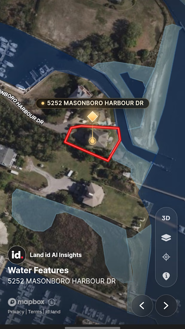
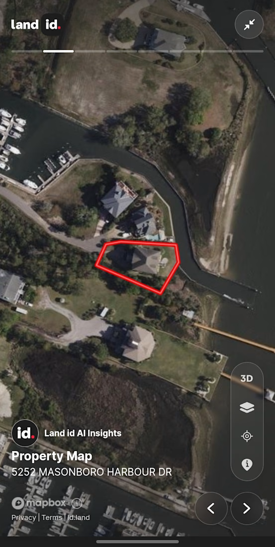
I build interactive Land & Real Estate maps with Land.id + GIS
I turn property boundaries, flood zones, and survey data into clean, clickable maps for agents, developers, and land buyers.
Stack: QGIS, ArcGIS, Land.id, Mapbox
Open to small fixes and full projects - DM if you need a property map, parcel report, or GIS cleanup.
Portfolio in bio.
#QGIS #ArcGIS #Land #RealEstate #GIS

The network for creativity
Join 1.25M professional creatives like you
Connect with clients, get discovered, and run your business 100% commission-free
Creatives on Contra have earned over $150M and we are just getting started





Related posts



Created a high-quality real estate social media video showcasing the lifestyle, location, commute, local amenities, schools, and surrounding community. I combined drone footage, stock visuals, clean typography, motion graphics, and engaging transitions to create a polished video designed to capture potential buyers’ attention.


Combining commute, amenities, and lifestyle footage builds a complete property story.

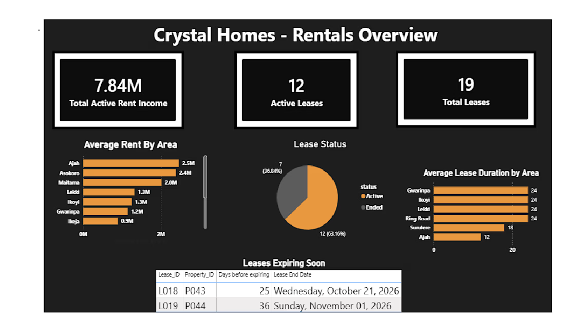
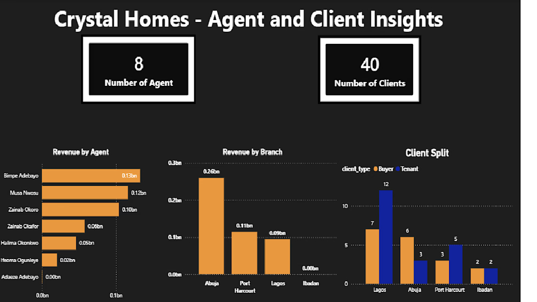
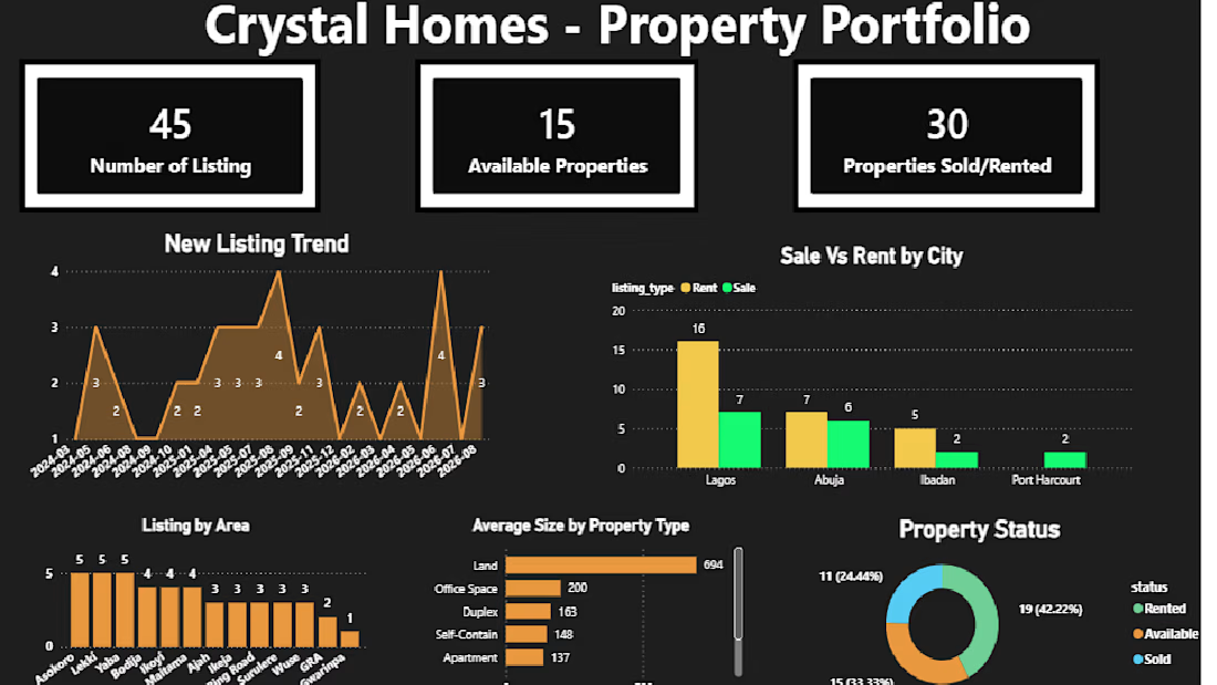
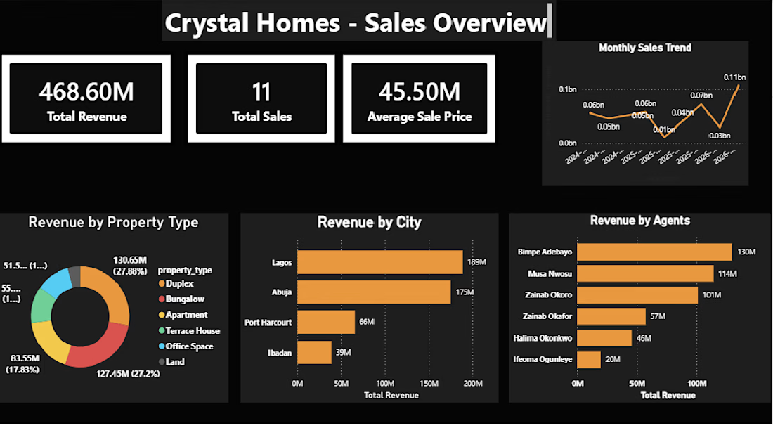
Crystal Homes: Real Estate Sales and Rental Analytics Dashboard
End-to-end analytics project for a fictional Nigerian real estate agency. Raw data from Google Sheets went into MySQL, where I built 21 SQL views, then into a 4-page Power BI dashboard covering sales performance, active rental income, lease expiry tracking, portfolio health, and agent/branch performance. It surfaced findings like ₦468M in tracked revenue and cross-branch sales attribution.
Tools: MySQL, Power BI, SQL, Google Sheets