The network for creativity
Join 1.25M professional creatives like you
Connect with clients, get discovered, and run your business 100% commission-free
Creatives on Contra have earned over $150M and we are just getting started
Back to feedPost

In 2024, while working as a Senior Research Analyst at Modesto Junior College, I built this Program Enrollment by Zip Code dashboard in Power BI to help leadership and outreach staff see where students live across the region and how that changes over time.
I pulled enrollment data from our student system, aggregated it at the program and ZIP code level, and joined it with spatial data so we could map enrollment by county and neighborhood. Filters allow users to slice by year, city, and ZIP code, with a privacy threshold hiding ZIP codes with very few students.
Deans and outreach staff use this dashboard to spot growth or decline and plan recruiting and marketing efforts.
Link http://app.powerbi.com/view?r=eyJrIjoiZmYzMGVlNjAtNzc5OS00ZWU4LWJjZjAtNTAyNzEyMmRlYjM0IiwidCI6IjNkMzVhZmU2LTI2YWMtNDM3ZS1iNGIzLTc1YjUwZDQ1OWU0NSIsImMiOjZ9


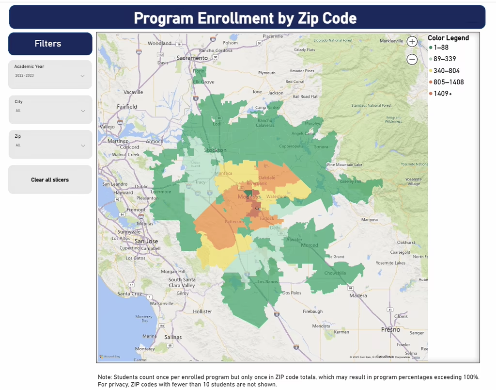

This is a strong example of how combining enrollment data with spatial analysis supports smarter outreach decisions. The privacy threshold and flexible filters make it both responsible and highly practical for leadership use.
The network for creativity
Join 1.25M professional creatives like you
Connect with clients, get discovered, and run your business 100% commission-free
Creatives on Contra have earned over $150M and we are just getting started

Challenges
View all