
Burak Kopan
Full-Stack Developer | Building AI & 3D SaaS Solutions
New to Contra
Burak is ready for their next project!
Dxf Analysis with Claude Ai Api
0
19
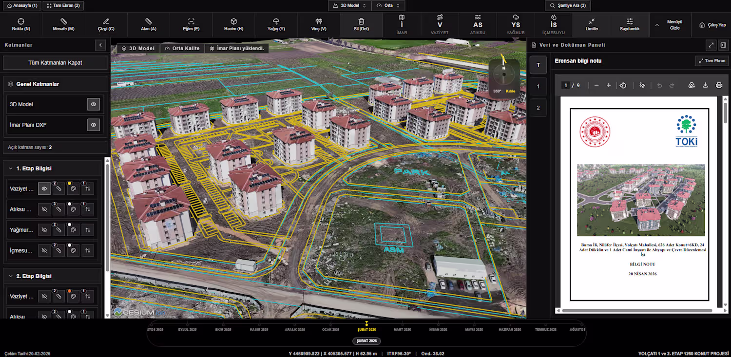
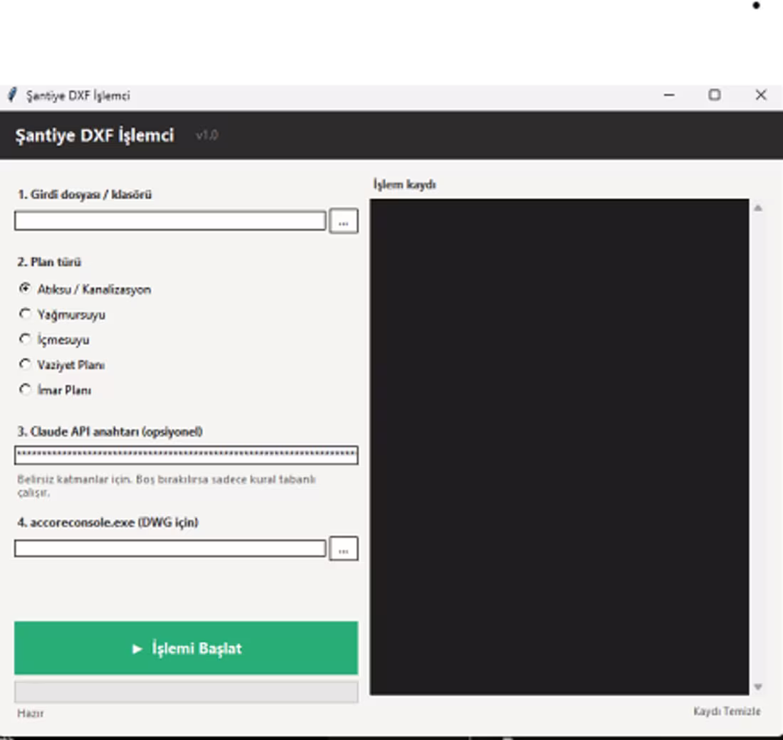
Geospatial Data Optimizer: DXF to 3D Tileset Elevation Aligner
Project Description (Bunu kopyalayabilirsin)
"I developed this custom local application to solve a critical challenge in 3D GIS workflows: Aligning 2D CAD data with 3D terrain and models.
The tool automates the process of converting DXF plans into optimized JSON data. It then reads the elevation (Z-value) from the corresponding 3D Tileset and automatically updates the converted data to ensure perfect 3D alignment.
Key Technical Achievements:
Automated Elevation Mapping: Dynamically reads and assigns Z-values from tilesets to 2D JSON objects.
Performance Optimization: Drastically reduces 3D data size for faster web-based rendering.
Seamless CAD Integration: Bridges the gap between traditional engineering plans (DXF) and modern 3D web environments (CesiumJS/SaaS).
This tool significantly accelerates the 'Construction Monitoring' workflow by allowing engineers to overlay technical plans onto 3D models with high precision.
1
47
Title: AI-Powered Geospatial Real Estate Assistant
Tools: Next.js, OpenAI API, Google Maps API, Tailwind CSS, Supabase.
Description:
Developed an AI-driven SaaS platform that automates high-conversion real estate listings.
Geospatial Intelligence: Integrated map-based location analysis to automatically fetch and highlight nearby amenities (schools, transport, social hubs).
Multi-Platform Content Engine: Leveraged OpenAI to generate platform-specific (Instagram, Facebook, Portals) descriptions in multiple languages.
Automated Workflow: Streamlined the listing process from raw property data to professional, SEO-optimized marketing copy.
1
36
Title: Standard-Compliant 3D Tiles & Earthwork Analysis Platform
Role: Full-Stack Developer &GIS Specialist
Description:
Developed a high-performance interactive 3D construction monitoring platform.
Implemented OGC 3D Tiles standard via CesiumJS for seamless navigation through gigabyte-scale site models.
Built integrated engineering tools, enabling instant volume calculation, earthwork analysis, and 2D plan overlays directly on 3D digital twins.
Ensured 30FPS+ real-time performance via optimized LOD-based rendering.
0
45