
GIS & AI Spatial IntelligenceEmily G

Turn raw spatial data and messy maps into automated, high-impact workflows in 7 days.
Most organizations sit on mountains of geographic data, outdated polygon layers, and underutilized mapping software that teams struggle to adopt.
This fixed-scope, 7-day sprint gives you a comprehensive architectural and operational audit of your current GIS and spatial data ecosystem. We diagnose workflow bottlenecks, identify opportunities to integrate automated AI intelligence layers, and deliver an actionable roadmap to accelerate software adoption across your team.
What’s Included in the Audit
Spatial Data & Architecture Review
Comprehensive assessment of your current mapping stack (ArcGIS, PostGIS, custom web maps, or database structures).
Evaluation of coordinate systems, geocoding pipelines, and layer hierarchy for performance and accuracy.
AI Integration Opportunities Assessment
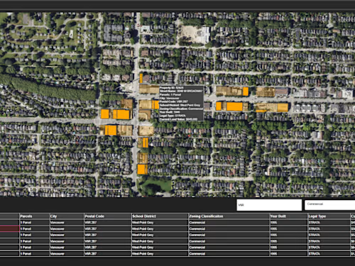
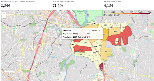
Pinpointing exact workflows where machine learning or predictive analytics can replace manual data processing (e.g., automated site selection, real-time zoning analysis, or spatial forecasting).
Software Adoption & UX Bottleneck Report
Identifying why team members or clients may be struggling to use your current tools.
Recommendations for intuitive UI/UX tweaks, custom popups, and streamlined workflows to boost daily usage.
Actionable Roadmap & Prioritized Backlog
A clear, step-by-step implementation guide detailing what to fix first for maximum ROI.
Timeline & Deliverables
Duration: 1 Week (Fast turnaround)
Deliverable 1: A 15-page Spatial & AI Audit PDF Report detailing findings and optimization strategies.
Deliverable 2: A 45-minute live strategy walkthrough and Q&A session to review the findings with your team.
Why Clients Book This Service
Zero Guesswork: Get an expert, objective evaluation of your spatial stack before investing thousands into custom development.
Speed to Value: Cut months of trial-and-error down to a single week with a clear technical blueprint.
Adoption-First Focus: Bridge the gap between complex GIS backend data and the non-technical stakeholders who actually need to use it.




GIS & AI Spatial IntelligenceEmily G
Starting at$50 /hr
Tags
ArcGIS
Python
AI
Data
Turn raw spatial data and messy maps into automated, high-impact workflows in 7 days.
Most organizations sit on mountains of geographic data, outdated polygon layers, and underutilized mapping software that teams struggle to adopt.
This fixed-scope, 7-day sprint gives you a comprehensive architectural and operational audit of your current GIS and spatial data ecosystem. We diagnose workflow bottlenecks, identify opportunities to integrate automated AI intelligence layers, and deliver an actionable roadmap to accelerate software adoption across your team.
What’s Included in the Audit
Spatial Data & Architecture Review
Comprehensive assessment of your current mapping stack (ArcGIS, PostGIS, custom web maps, or database structures).
Evaluation of coordinate systems, geocoding pipelines, and layer hierarchy for performance and accuracy.
AI Integration Opportunities Assessment
Pinpointing exact workflows where machine learning or predictive analytics can replace manual data processing (e.g., automated site selection, real-time zoning analysis, or spatial forecasting).
Software Adoption & UX Bottleneck Report
Identifying why team members or clients may be struggling to use your current tools.
Recommendations for intuitive UI/UX tweaks, custom popups, and streamlined workflows to boost daily usage.
Actionable Roadmap & Prioritized Backlog
A clear, step-by-step implementation guide detailing what to fix first for maximum ROI.
Timeline & Deliverables
Duration: 1 Week (Fast turnaround)
Deliverable 1: A 15-page Spatial & AI Audit PDF Report detailing findings and optimization strategies.
Deliverable 2: A 45-minute live strategy walkthrough and Q&A session to review the findings with your team.
Why Clients Book This Service
Zero Guesswork: Get an expert, objective evaluation of your spatial stack before investing thousands into custom development.
Speed to Value: Cut months of trial-and-error down to a single week with a clear technical blueprint.
Adoption-First Focus: Bridge the gap between complex GIS backend data and the non-technical stakeholders who actually need to use it.
$50 /hr