
GIS AnalystFELIX OMOLO

I offer a comprehensive suite of deliverables, including an interactive geospatial web application, in-depth spatial analysis, custom map visualizations, and thorough user training and documentation. Our unique approach combines advanced geospatial technology with clear, user-friendly interfaces and detailed analytical insights, ensuring that clients receive not only cutting-edge tools but also the knowledge and support to utilize them effectively.
What's included
Interactive Map Platform
A web-based platform that displays geospatial data in an interactive map format. The platform will allow users to explore, analyze, and visualize spatial data, including layers such as terrain, weather, and demographic information.
Formats:
-Web Application (hosted on a specified server)
-Source Code (provided in a GitHub repository or as a downloadable ZIP file)
Quantities: 1 web application, 1 source code package
Revisions: Up to 3 rounds of revisions after initial delivery
Other Details: Includes user authentication, mobile responsiveness, and basic user documentation for navigating the platform.
Final Project Report
A comprehensive document outlining the project's objectives, methodology, results, and conclusions. This report will include technical details, analysis of data, and visualizations such as charts and graphs.
Formats:
-PDF (primary format)
-Word Document (editable format)
Quantities: 1 report
Revisions: Up to 2 rounds of revisions after the initial draft
Other Details: The report will include an executive summary, detailed methodology, and appendices with raw data and supplementary information.
User Training Sessions and Documentation
A series of training sessions for end-users, along with comprehensive documentation. The training will cover how to use the geospatial web application, including navigation, data analysis, and exporting data.
Formats:
-Training Sessions (conducted via video conferencing)
-User Manual (PDF and HTML formats)
-Training Videos (MP4 format)
Quantities: 3 training sessions, 1 user manual, 3 training videos
Revisions: N/A for training sessions; up to 1 round of updates for documentation and videos after initial review
Other Details: Training sessions will be recorded and provided to the client for future reference. The user manual will include step-by-step instructions and troubleshooting tips.
Comprehensive Spatial Analysis
A detailed report providing insights and analysis based on spatial data. This includes identifying patterns, trends, and relationships within the data using techniques such as spatial clustering, heat mapping, and buffer analysis.
Formats:
-PDF (primary format)
-Excel/CSV (for accompanying data tables and analysis)
Quantities: 1 report
Revisions: Up to 2 rounds of revisions after the initial draft
Other Details: The report will include visual aids like maps and charts, a detailed methodology section explaining the analysis techniques used, and a summary of key findings and recommendations.
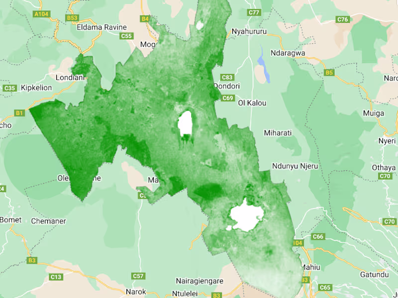
Custom Map Visualization Set
A collection of custom map visualizations tailored to specific project needs. These maps will highlight key data points, trends, and spatial relationships, and may include thematic maps, choropleth maps, and other specialized visualizations.
Formats:
-High-Resolution Images (PNG/JPEG)
-Interactive Web Maps (hosted online or provided as files)
Quantities: 5 high-resolution static maps, 3 interactive web maps
Revisions: Up to 2 rounds of revisions per map after the initial delivery
Other Details: The maps will be designed to be visually appealing and easy to interpret, with clear legends, labels, and annotations. The interactive maps will include features such as zoom, pan, and layer toggling.
FAQs
FELIX's other services
Starting at$25 /hr
Tags
Conda
Google ML Engine
Python
QGIS
Data Analyst
Data Modelling Analyst
Data Scientist
Service provided by
FELIX OMOLO Nairobi, Kenya
GIS AnalystFELIX OMOLO
Starting at$25 /hr
Tags
Conda
Google ML Engine
Python
QGIS
Data Analyst
Data Modelling Analyst
Data Scientist
I offer a comprehensive suite of deliverables, including an interactive geospatial web application, in-depth spatial analysis, custom map visualizations, and thorough user training and documentation. Our unique approach combines advanced geospatial technology with clear, user-friendly interfaces and detailed analytical insights, ensuring that clients receive not only cutting-edge tools but also the knowledge and support to utilize them effectively.
What's included
Interactive Map Platform
A web-based platform that displays geospatial data in an interactive map format. The platform will allow users to explore, analyze, and visualize spatial data, including layers such as terrain, weather, and demographic information.
Formats:
-Web Application (hosted on a specified server)
-Source Code (provided in a GitHub repository or as a downloadable ZIP file)
Quantities: 1 web application, 1 source code package
Revisions: Up to 3 rounds of revisions after initial delivery
Other Details: Includes user authentication, mobile responsiveness, and basic user documentation for navigating the platform.
Final Project Report
A comprehensive document outlining the project's objectives, methodology, results, and conclusions. This report will include technical details, analysis of data, and visualizations such as charts and graphs.
Formats:
-PDF (primary format)
-Word Document (editable format)
Quantities: 1 report
Revisions: Up to 2 rounds of revisions after the initial draft
Other Details: The report will include an executive summary, detailed methodology, and appendices with raw data and supplementary information.
User Training Sessions and Documentation
A series of training sessions for end-users, along with comprehensive documentation. The training will cover how to use the geospatial web application, including navigation, data analysis, and exporting data.
Formats:
-Training Sessions (conducted via video conferencing)
-User Manual (PDF and HTML formats)
-Training Videos (MP4 format)
Quantities: 3 training sessions, 1 user manual, 3 training videos
Revisions: N/A for training sessions; up to 1 round of updates for documentation and videos after initial review
Other Details: Training sessions will be recorded and provided to the client for future reference. The user manual will include step-by-step instructions and troubleshooting tips.
Comprehensive Spatial Analysis
A detailed report providing insights and analysis based on spatial data. This includes identifying patterns, trends, and relationships within the data using techniques such as spatial clustering, heat mapping, and buffer analysis.
Formats:
-PDF (primary format)
-Excel/CSV (for accompanying data tables and analysis)
Quantities: 1 report
Revisions: Up to 2 rounds of revisions after the initial draft
Other Details: The report will include visual aids like maps and charts, a detailed methodology section explaining the analysis techniques used, and a summary of key findings and recommendations.
Custom Map Visualization Set
A collection of custom map visualizations tailored to specific project needs. These maps will highlight key data points, trends, and spatial relationships, and may include thematic maps, choropleth maps, and other specialized visualizations.
Formats:
-High-Resolution Images (PNG/JPEG)
-Interactive Web Maps (hosted online or provided as files)
Quantities: 5 high-resolution static maps, 3 interactive web maps
Revisions: Up to 2 rounds of revisions per map after the initial delivery
Other Details: The maps will be designed to be visually appealing and easy to interpret, with clear legends, labels, and annotations. The interactive maps will include features such as zoom, pan, and layer toggling.
FAQs
FELIX's other services
$25 /hr