
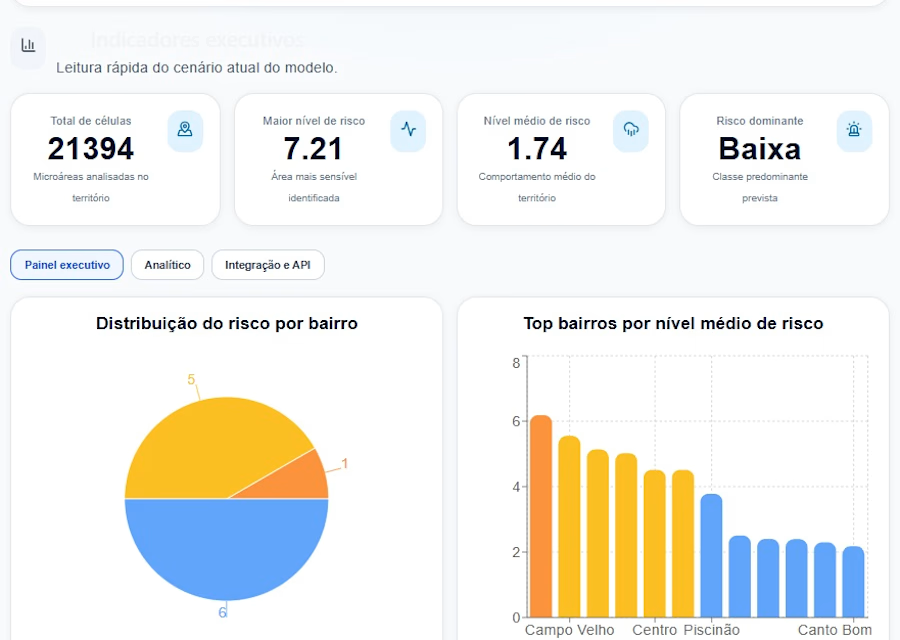
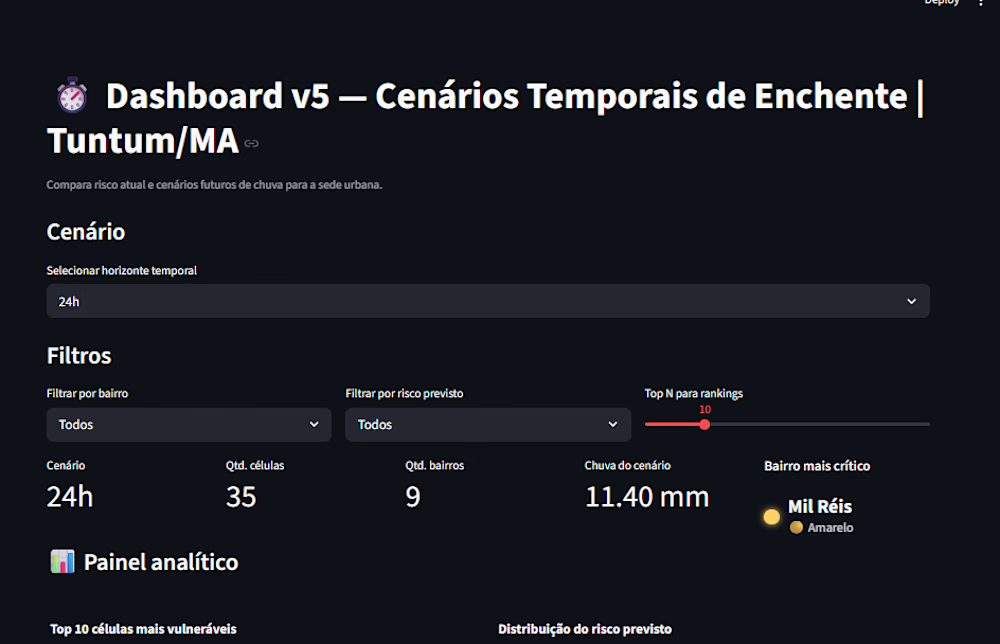
GeoAlerta AI is an advanced climate intelligence platform that combines artificial intelligence, geospatial analytics, and environmental data to predict and mitigate urban flooding risks.
Designed for governments, NGOs, and smart city initiatives, the system integrates satellite imagery, terrain elevation models (DEM), rainfall data, and machine learning algorithms to generate real-time risk scores and interactive maps.
The platform transforms complex environmental data into actionable insights, helping decision-makers identify high-risk areas, prioritize interventions, and optimize resource allocation.
GeoAlerta AI is especially focused on emerging cities, where data scarcity and infrastructure challenges demand innovative, scalable, and cost-effective solutions.
WHAT THIS PROJECT DELIVERS
Flood risk prediction using AI models
Interactive geospatial dashboards
Risk scoring system (0–10 scale)
Integration with satellite and climate data
Identification of high-risk neighborhoods
API for real-time data access
Decision support for public managers
TECH STACK
Python (Pandas, GeoPandas, Scikit-learn)
FastAPI (REST APIs)
Plotly / Streamlit (Dashboards)
PostgreSQL / PostGIS
Docker
Satellite Data (DEM, rainfall APIs)
USE CASES
Smart Cities & Urban Planning
Disaster Prevention & Civil Defense
Climate Risk Monitoring
Public Policy Decision Support
Infrastructure Planning
IMPACT
Reduces disaster response time
Improves public resource allocation
Enhances urban resilience
Supports data-driven governance
Protects vulnerable communities
DIFFERENTIAL
Unlike traditional systems, GeoAlerta AI combines:
AI + Geospatial Intelligence + Real-time Data
Focus on emerging cities (low-cost, scalable)
Easy-to-understand dashboards for non-technical users
Ready-to-integrate API architecture
SKILLS
Artificial Intelligence
Machine Learning
Geospatial Analysis
Climate Risk Modeling
Python
Data Visualization
Predictive Modeling
Smart Cities
Decision Support Systems
Get it for$1,000.00
Tags
AI-powered geospatial platform for predicting floods and enabling data-driven decisions in emerging cities.
Product created by
Gilliard Léda Brazil
- 5
- Followers
Get it for$1,000.00
Tags
AI-powered geospatial platform for predicting floods and enabling data-driven decisions in emerging cities.
GeoAlerta AI is an advanced climate intelligence platform that combines artificial intelligence, geospatial analytics, and environmental data to predict and mitigate urban flooding risks.
Designed for governments, NGOs, and smart city initiatives, the system integrates satellite imagery, terrain elevation models (DEM), rainfall data, and machine learning algorithms to generate real-time risk scores and interactive maps.
The platform transforms complex environmental data into actionable insights, helping decision-makers identify high-risk areas, prioritize interventions, and optimize resource allocation.
GeoAlerta AI is especially focused on emerging cities, where data scarcity and infrastructure challenges demand innovative, scalable, and cost-effective solutions.
WHAT THIS PROJECT DELIVERS
Flood risk prediction using AI models
Interactive geospatial dashboards
Risk scoring system (0–10 scale)
Integration with satellite and climate data
Identification of high-risk neighborhoods
API for real-time data access
Decision support for public managers
TECH STACK
Python (Pandas, GeoPandas, Scikit-learn)
FastAPI (REST APIs)
Plotly / Streamlit (Dashboards)
PostgreSQL / PostGIS
Docker
Satellite Data (DEM, rainfall APIs)
USE CASES
Smart Cities & Urban Planning
Disaster Prevention & Civil Defense
Climate Risk Monitoring
Public Policy Decision Support
Infrastructure Planning
IMPACT
Reduces disaster response time
Improves public resource allocation
Enhances urban resilience
Supports data-driven governance
Protects vulnerable communities
DIFFERENTIAL
Unlike traditional systems, GeoAlerta AI combines:
AI + Geospatial Intelligence + Real-time Data
Focus on emerging cities (low-cost, scalable)
Easy-to-understand dashboards for non-technical users
Ready-to-integrate API architecture
SKILLS
Artificial Intelligence
Machine Learning
Geospatial Analysis
Climate Risk Modeling
Python
Data Visualization
Predictive Modeling
Smart Cities
Decision Support Systems
$1,000.00