Freelancers using Agisoft Metashape
Freelancers using Agisoft Metashape
Sign Up
Post a job
Sign Up
Log In
Filters
1
Projects
People
3d WebGL
Wrocław, Poland
WebGL Engineer & 3D Artist Innovating Quality 3D since 2011
8
Followers
Follow
Message
WebGL Engineer & 3D Artist Innovating Quality 3D since 2011
0
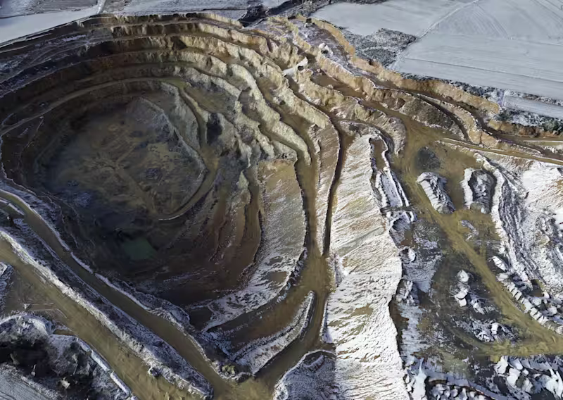
Having fun with terrain 3d scans in Blender. Little artistic flavor added to geospatial data presentation. I just like these as all sources are color calibrated and go well with any lighting.
0
258
0
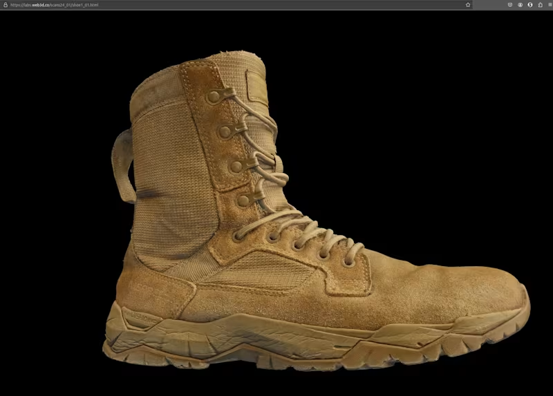
Small 3D proof-of-concept demonstrating object scanning and photogrammetry using cross-polarized lighting. Focused on achieving sub-millimeter detail and high-quality surface reconstruction for Web-based 3D applications. This time without configuration or interactivity.
0
139
0
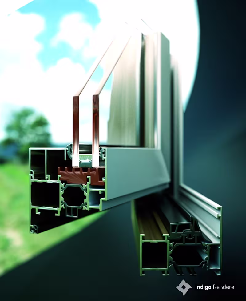
Product renderings of aluminium window systems, created end-to-end with custom 3D modeling and HDRI lighting.
0
241
15
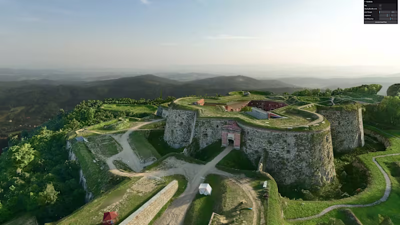
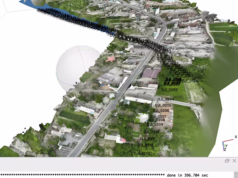
17th-Century Fortress – UAV 3D Scanning & Web-Based Virtual Experience A historic fortress from the Napoleonic Wars era was captured using UAV-based photogrammetry and reconstructed into a detailed 3D model, including the full terrain and surrounding landscape to preserve historical context. The interactive virtual experience is delivered directly in a web browser and is built using open-source technologies from NASA’s AMMOS (Advanced Multimission Operations System), adapted for real-time exploration of cultural heritage sites.
15
426
Agisoft Metashape
(4)
Follow
Message
Sadaqat Ali
Islamabad, Pakistan
Where geography meets design excellence
New to Contra
Follow
Message
Where geography meets design excellence
0
Created a 3D urban parking facility model for a city development project, showcasing efficient parking layouts, traffic circulation, and public accessibility. The visualization supported urban planning, infrastructure design, and decision-making processes.
0
25
0
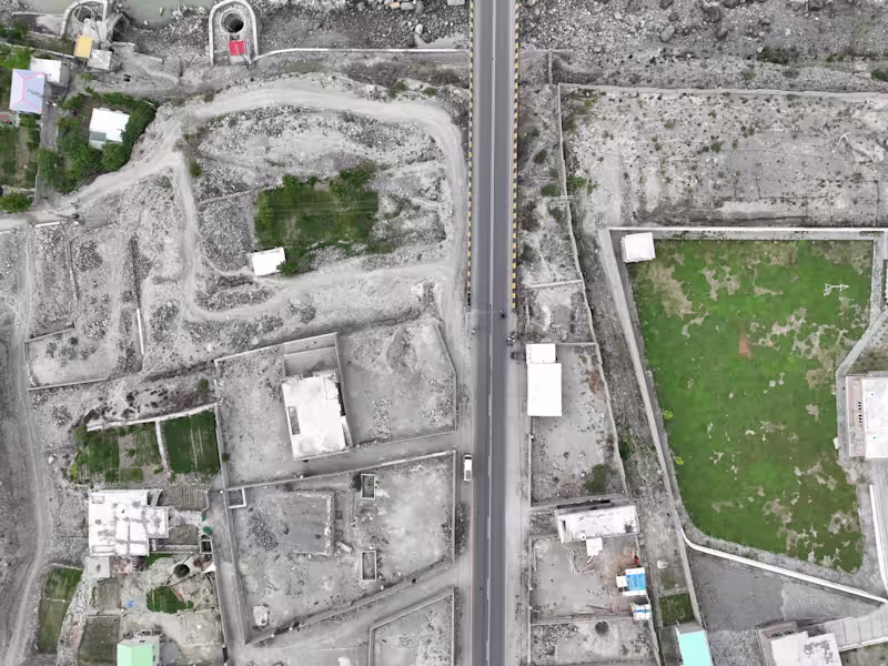
Developed a high-resolution 3D road corridor model using GIS and terrain data to visualize road alignment, elevation profiles, and surrounding landscapes. The project delivered realistic engineering-grade visualizations for planning, stakeholder presentations, and project documentation.
0
32
0
Geospatial Analyst & 3D Modeling Specialist for Infrastructure, Mining & Urban Development
0
40
0
Designed and developed an interactive web visualization application featuring dynamic maps, data dashboards, and user-friendly analytics. The platform enables efficient exploration of complex data through responsive and visually engaging interfaces.
0
21
Agisoft Metashape
(3)
Follow
Message
António Maria Oliveira Martins
Aveiro, Portugal
Im a 3D artist and product designer
Follow
Message
Im a 3D artist and product designer
0
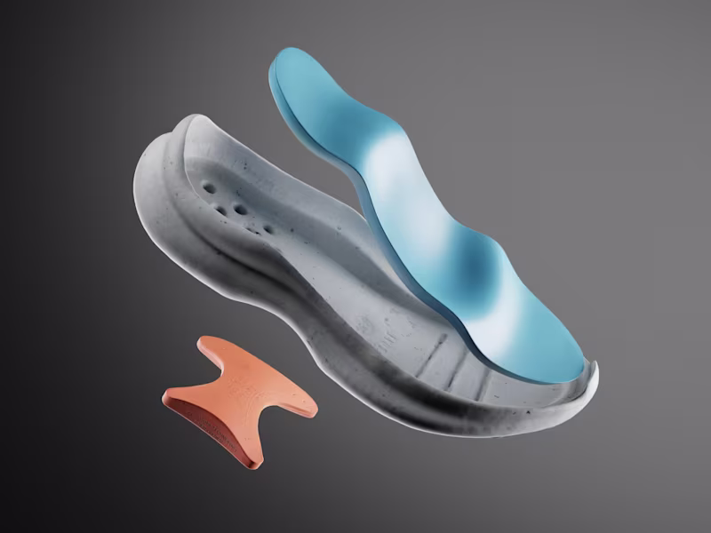
António Martins - Design - ARCOPÉDICO
0
1
0
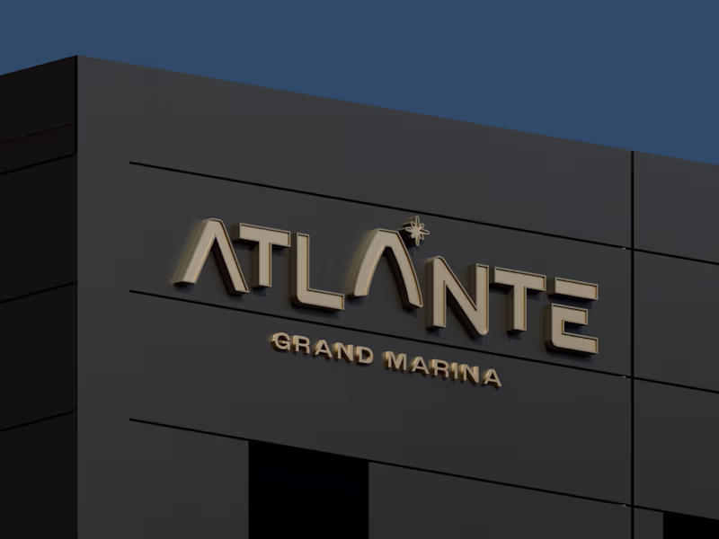
Atlante Grand Marina 3D Visualization
0
2
0
Salatia Maritime Brand Development
0
2
0
António Martins - Design - BREEZE
0
1
Agisoft Metashape
(1)
Follow
Message
Explore people