Projects using Leaflet in LahoreProjects using Leaflet in Lahore🗺️ Web GIS for Field Operations & Location-Based Data Collection
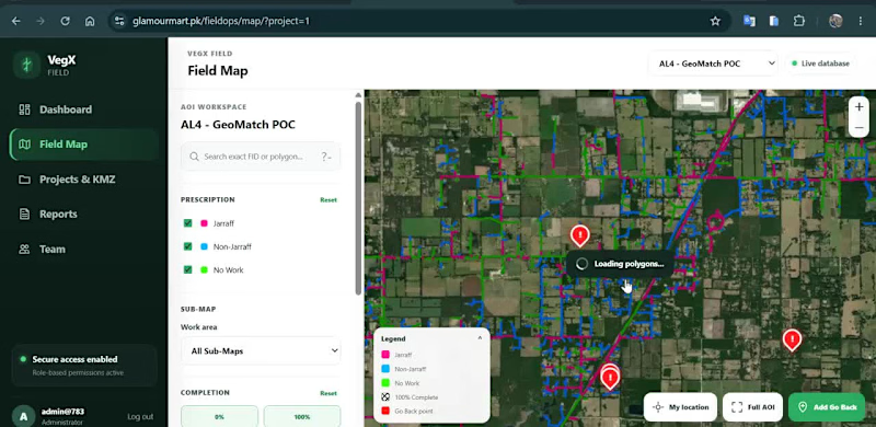
I developed an interactive geospatial platform designed to help teams visualize, manage and update field-work information directly on a map.
The application combines Web GIS, satellite imagery, spatial data management and field reporting in a single workflow.
Key capabilities include:
• Interactive field map with spatial work areas
• Color-coded work / prescription classifications
• Multiple GIS sub-maps and project views
• Satellite and OpenStreetMap basemap switching
• Work completion and status tracking
• Location-based field-point creation
• GPS coordinate capture
• Field categorization and notes
• Photo attachment support for field observations
• Map-based project and team workflows
The goal is to replace disconnected field records with a centralized spatial workflow, where teams can see exactly where work is required, record observations from the field, and maintain geographically accurate project information.
Built around Web GIS, spatial databases and interactive mapping.
Interested in projects involving GIS development, field-data collection, asset management, spatial dashboards and geospatial workflow automation.