Freelancers using QGIS in Ko Tao
Freelancers using QGIS in Ko Tao
Sign Up
Post a job
Sign Up
Log In
Filters
2
Projects
People
Shaun Ducker
Ko Tao, Thailand
UAV Photogrammetry & GIS Specialist | Metashape + QGIS
New to Contra
Follow
Message
UAV Photogrammetry & GIS Specialist | Metashape + QGIS
0
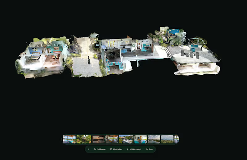
Shades of Blue is a complete property reality-capture and interactive 3D experience built for a luxury villa in Thailand. The project combined exterior drone photogrammetry, detailed 3D reconstruction and interior 360° capture into a single explorable property experience. I handled the workflow from capture and processing through to the final interactive presentation, including: • Exterior UAV photogrammetry • Detailed textured 3D property model • Interior 360° walkthrough • Spatial navigation between rooms • Floor-plan and dollhouse-style views • Terrain and surrounding landscape context • Optimisation for an interactive web-based property viewer The goal was to let potential buyers and clients understand the entire property remotely — both inside and outside — in a way that standard photography cannot.
0
15
0
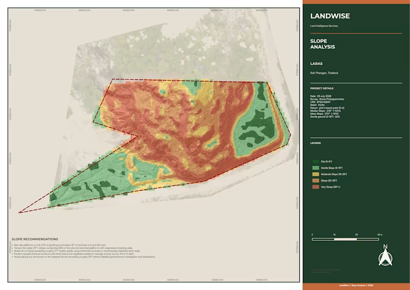
Complete UAV photogrammetry and geospatial processing project for a hillside property in Thailand. I processed 1,272 aerial images in Agisoft Metashape Professional and QGIS, producing a high-resolution orthomosaic, dense point cloud, ground-classified terrain data, DTM/DEM, 0.5 m contours, elevation analysis and a detailed 3D reconstruction. The dataset generated more than 376 million dense points, including over 121 million ground-classified points, with mapping outputs at approximately 1 cm resolution. The final deliverables were prepared for practical land and property analysis, with clear visual outputs showing terrain, elevation, slope and site conditions.
0
21
0
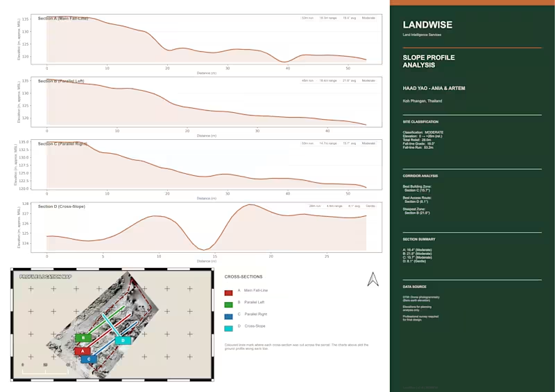
Complete UAV photogrammetry and geospatial processing project for a hillside property in Thailand. I processed 1,272 aerial images in Agisoft Metashape Professional and QGIS, producing a high-resolution orthomosaic, dense point cloud, ground-classified terrain data, DTM/DEM, 0.5 m contours, elevation analysis and a detailed 3D reconstruction. The dataset generated more than 376 million dense points, including over 121 million ground-classified points, with mapping outputs at approximately 1 cm resolution. The final deliverables were prepared for practical land and property analysis, with clear visual outputs showing terrain, elevation, slope and site conditions.
0
22
0
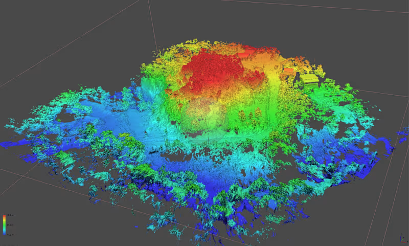
Complete UAV photogrammetry and geospatial processing project for a hillside property in Thailand. I processed 1,272 aerial images in Agisoft Metashape Professional and QGIS, producing a high-resolution orthomosaic, dense point cloud, ground-classified terrain data, DTM/DEM, 0.5 m contours, elevation analysis and a detailed 3D reconstruction. The dataset generated more than 376 million dense points, including over 121 million ground-classified points, with mapping outputs at approximately 1 cm resolution. The final deliverables were prepared for practical land and property analysis, with clear visual outputs showing terrain, elevation, slope and site conditions.
0
32
QGIS
(4)
Follow
Message
Explore people