The network for creativity
Join 1.25M professional creatives like you
Connect with clients, get discovered, and run your business 100% commission-free
Creatives on Contra have earned over $150M and we are just getting started
Back to feedPost

Developed a full-stack web application designed to simplify the planning, management, and monitoring of drone survey operations across multiple sites. The platform provides a centralized interface for managing drone fleets, configuring survey missions, tracking mission progress, and analyzing operational performance through interactive dashboards and reports.
The application features an interactive, map-based mission planning system that allows users to define survey areas by placing waypoints on a map. Users can select different flight patterns, including Crosshatch, Perimeter, Grid, and Waypoint, and configure parameters such as flight altitude, overlap percentage, and speed. The system also calculates estimated survey coverage and mission duration to help users plan operations more efficiently.
The fleet management module allows users to maintain a complete inventory of drones, monitor their availability and status, and view details such as battery levels, location, and flight hours. Users can add new drones, update existing records, remove drones, and filter the fleet according to operational status, including available, in-mission, maintenance, and offline.
The real-time mission monitoring module provides a live map interface displaying drone positions, flight trails, and planned routes. It includes mission controls for starting, pausing, resuming, aborting, and completing missions. The monitoring dashboard also displays telemetry information such as battery level, speed, altitude, signal strength, heading, and estimated time of arrival. For demonstration purposes, the application simulates drone movement and telemetry updates based on mission progress.
The platform also includes a survey reporting and analytics dashboard that presents operational insights through KPI cards, interactive charts, mission status breakdowns, flight pattern statistics, fleet health indicators, and site-level activity reports. A dedicated site management module enables users to create, update, and delete survey sites while maintaining their names, locations, GPS coordinates, and area details.
The frontend was developed using React and Vite, with reusable components, structured navigation, and responsive dashboard layouts. The backend was built using Node.js and Express.js, providing REST APIs for drone management, mission operations, site administration, and analytics. The application uses an in-memory JavaScript data store rather than a persistent database, making it suitable for demonstrating the system's functionality without additional database setup.
This project demonstrates practical full-stack development, REST API integration, interactive map visualisation, dashboard development, state management, and the implementation of mission workflows with validation and error handling.


The network for creativity
Join 1.25M professional creatives like you
Connect with clients, get discovered, and run your business 100% commission-free
Creatives on Contra have earned over $150M and we are just getting started







Related posts

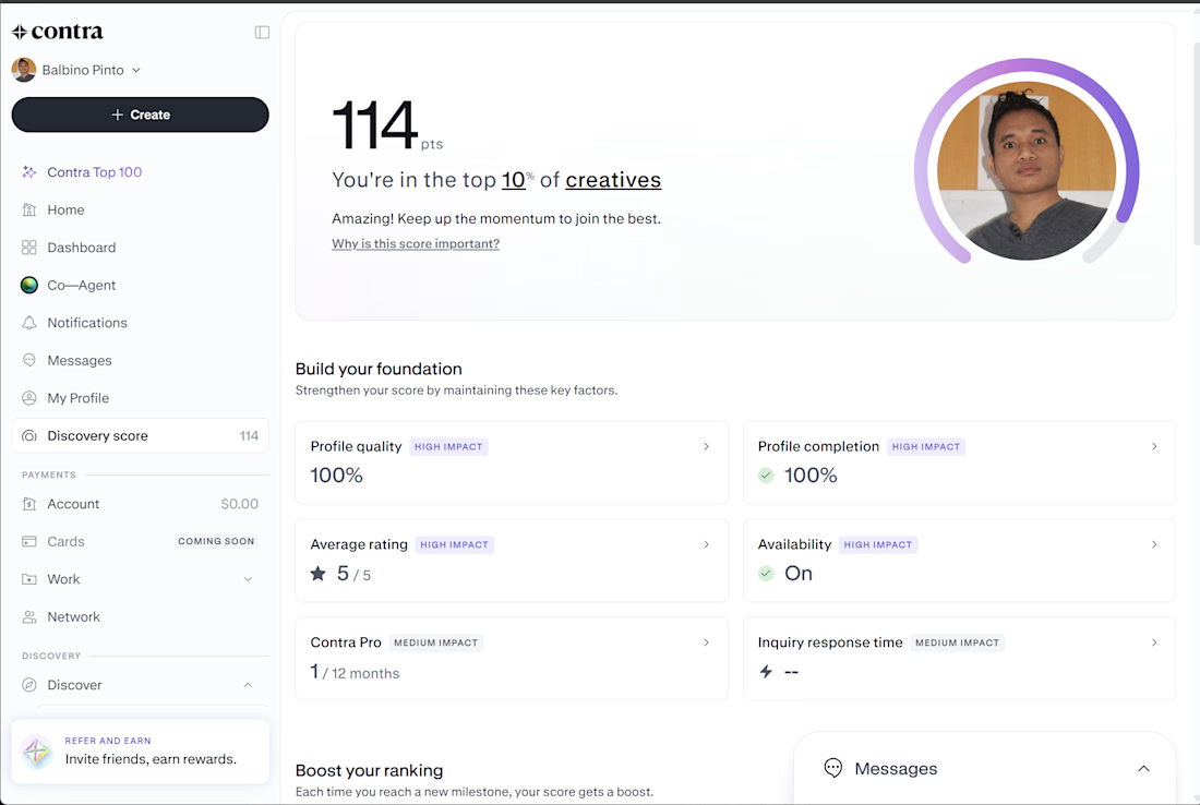
My Contra Discovery Score has reached 114 points, placing me in the top 10% of creatives on the platform. My profile quality and profile completion are both at 100%, with a 5/5 average rating and availability turned on.
As a software engineer specializing in React, .NET, API development, and SAP Business One, I'm continuing to strengthen my Contra presence, showcase my portfolio, and connect with potential clients for new freelance opportunities.



A multi-page real estate website concept and a showcase video that walks through the whole site, not just the landing page. The project covers the full buyer journey, from first search to booking a viewing.
The site has five pages:
Home: a clear headline, a search bar for location, property type and budget, featured listings and a trust section with local sales stats.
Listings: a "Homes in Lakeview" page with filter chips, a six-home grid showing price, beds and baths, and a new-listing alerts banner.
Property detail: a photo gallery, price and monthly estimate, key specs, an about section with features, a payment estimate and an agent booking card.
Agents: team profiles, sales stats and the company story.
Contact: a "Book a viewing" form with office details.
The visual identity pairs deep slate with warm amber, a color that reads as home and daylight. Bricolage Grotesque carries the headlines, and Inter Tight handles body text. The listing illustrations are drawn in code, so the layout works before real photography is added.
The video shows the site on a 3D monitor and pedestal in front of a giant parallax wordmark. An animated cursor clicks through the navigation, a progress bar marks each page load, a listing card lifts on hover, and the booking form fills in live until "Request sent" appears. The camera orbits between pages and moves in close at each click so the interface stays readable. A synthesized sound bed with page-change whooshes, click sounds, typing ticks and a success chime completes it.


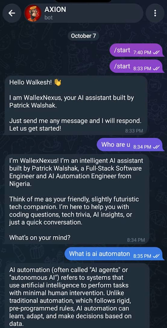
Title: AI Powered Telegram Chatbot
Description: A fully functional Telegram bot powered by Groq AI.
Handles conversations, remembers context and logs all messages
to a Supabase database. Deployed on Railway.
Link: https://t.me/WallexNexus_bot



How do you scope the Supabase conversation memory: per user, per chat, or both? I'd keep private-chat history out of group replies if the bot supports group conversations.