The network for creativity
Join 1.25M professional creatives like you
Connect with clients, get discovered, and run your business 100% commission-free
Creatives on Contra have earned over $150M and we are just getting started
Back to feedPost
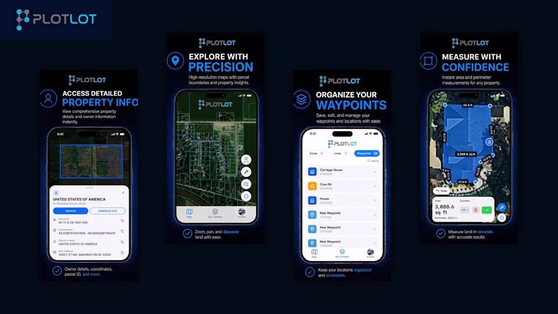
Built the mobile experience for Plotlot, focusing on creating a practical, GPS-driven utility app that helps users understand and manage real-world land and property boundaries with ease.
The goal was to design a simple yet powerful interface where users like homeowners, realtors, and surveyors can quickly access property insights, measure land areas, calculate distances, and view approximate boundaries using GPS data. I focused on structuring complex geolocation features into an intuitive flow that makes land visualization and measurement accessible for non-technical users.
Special attention was given to usability in outdoor conditions, ensuring the app remains responsive, clear, and reliable during real-time location tracking and mapping interactions.
Mobile App Development
UI/UX Design (GIS / Mapping Interface)
GPS & Location-Based Systems
Data Visualization (Land Mapping UI)
Performance Optimization for Mobile
Tools & Technologies:
Swift, iOS SDK, Core Location, MapKit, Figma, REST APIs
The network for creativity
Join 1.25M professional creatives like you
Connect with clients, get discovered, and run your business 100% commission-free
Creatives on Contra have earned over $150M and we are just getting started
Related posts
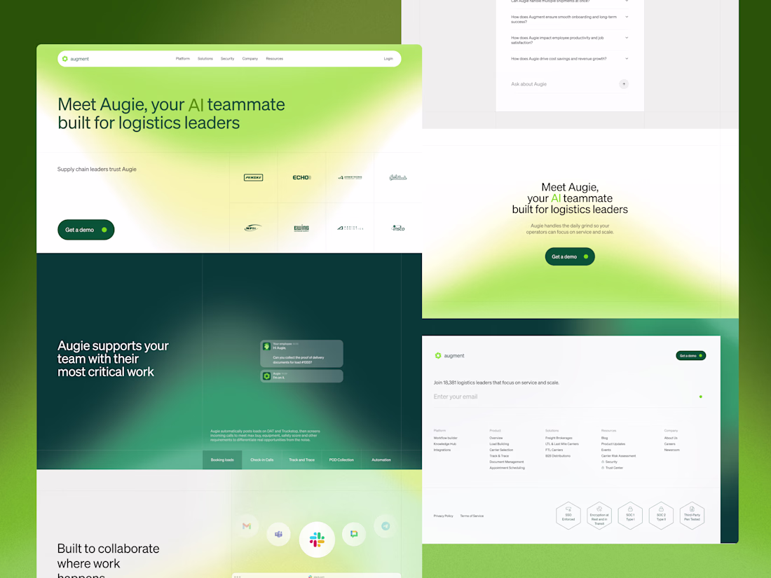
The strategic challenge for the full website was sequencing. A logistics leader landing on this page may understand the problem Augie solves but not yet understand what AI actually does for their team day to day.
Each section was built to answer one specific question in the order a visitor would naturally ask it. What does Augie do. Does it work with the tools we already use. Is it built for our specific type of operation.
Green runs through every section consistently, carrying the same brand language from trade show booth to digital so the brand feels the same wherever the audience encounters Augment. The grid gives the page rhythm without making it feel rigid, each section carrying its own structure while elements occasionally cross between them.
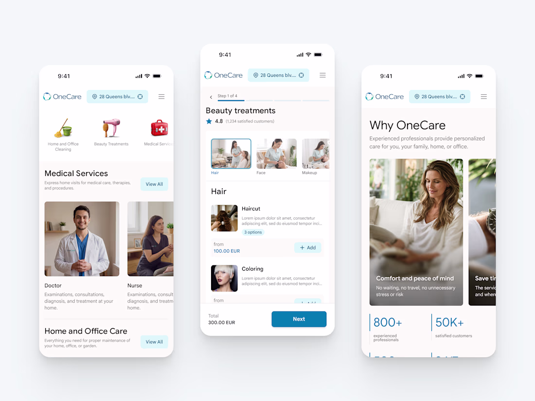
New project in the works - OneCare.
One app for premium care delivered to your address. Cleaning, beauty, healthcare at home, handyman, plumbing, pest control, pet care, laundry, and a lot more.
More to come soon 🤌
Nice work
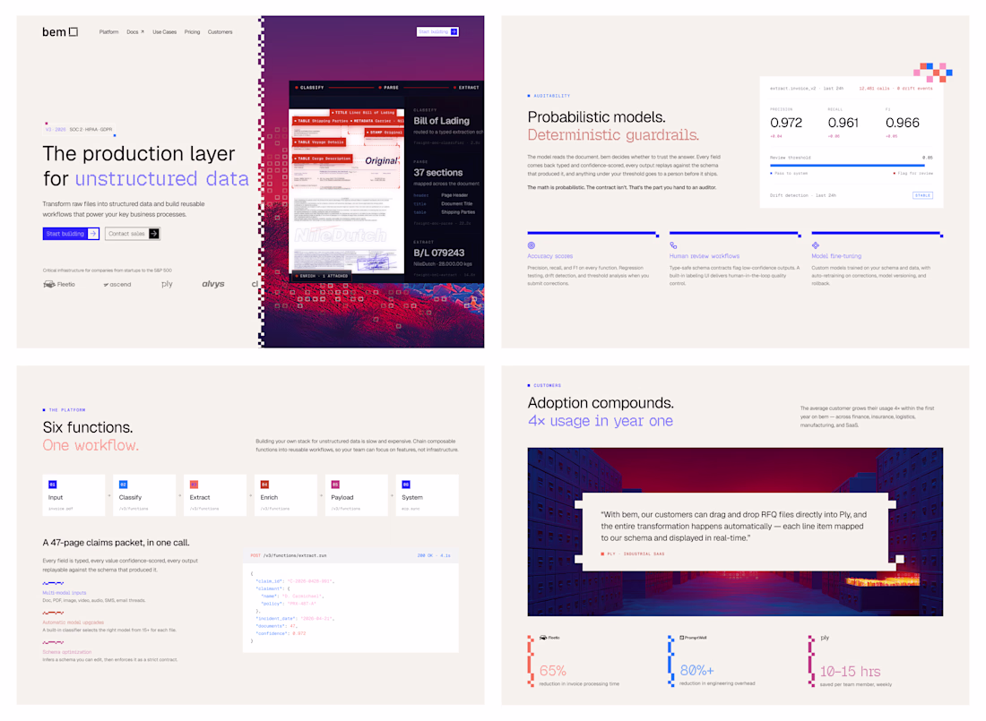
Web concept for bem. The product turns messy documents into structured data, so the brand does the same thing visually. Every image dissolves into pixels, every layout resolves back into grid.
How did you first come up with the idea to use pixel dissolution to represent unstructured data? Did you explore any other visual metaphors before landing on this one?
Trending
Claude
Claude has entered the design space. How are you using Claude Design?
Contra University
Learn from expert creatives how to earn more using next-gen AI tools.
creativeaiflow
Creative AI workflows are evolving. What tools do you use, and what are their strengths and weaknesses?
freelancerlife
Freelancer life is wins, pivots, and everything in between. What’s yours right now?