The network for creativity
Join 1.25M professional creatives like you
Connect with clients, get discovered, and run your business 100% commission-free
Creatives on Contra have earned over $150M and we are just getting started
Back to feedPost


The network for creativity
Join 1.25M professional creatives like you
Connect with clients, get discovered, and run your business 100% commission-free
Creatives on Contra have earned over $150M and we are just getting started











Related posts

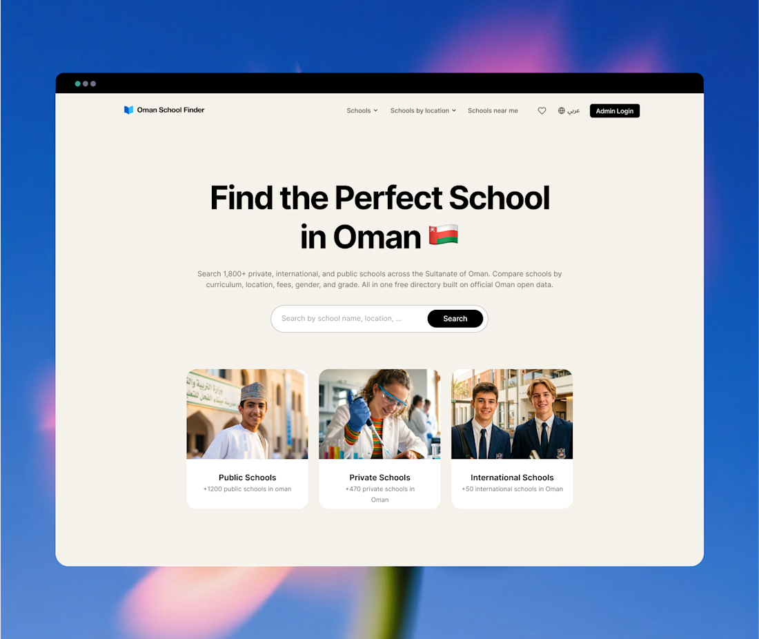
I built OmanSchoolFinder, now it's serving 16k parents to find and compare schools in Oman 🇴🇲.
- Listed over 1,800 schools, kg & nurseries
- 16K MAU + 70k page views/mo (22k MAU + 100k views on seasonal peak)
- 86% organic search; the rest is direct.



Love the design and the real impact this website has on helping people find schools and nurseries!

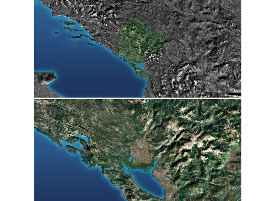
High-fidelity 3D terrain visualization and regional GIS mapping of Montenegro.
This project demonstrates advanced spatial design and processing of satellite imagery combined with digital elevation models (DEM). Focused on strict topographical accuracy, precise coastal outline of the Adriatic Sea, and realistic mountain relief modeling built for large-scale infrastructure masterplanning and regional asset presentations.



Amazing work on this Montenegro map! The relief details and the coastline precision look absolutely beautiful. Very high-quality work.

Elsewhere — a workspace for AI workers with their own computers, routines, and work history.