The network for creativity
Join 1.25M professional creatives like you
Connect with clients, get discovered, and run your business 100% commission-free
Creatives on Contra have earned over $150M and we are just getting started
Back to feedPost

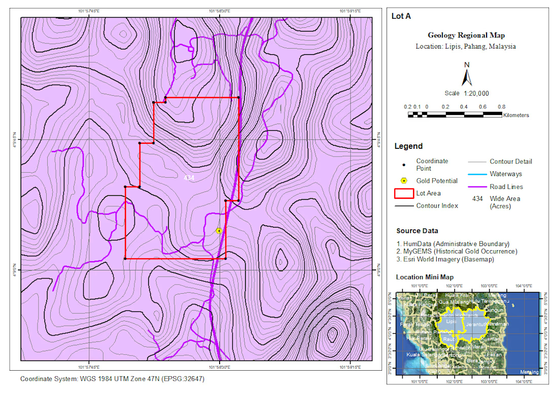
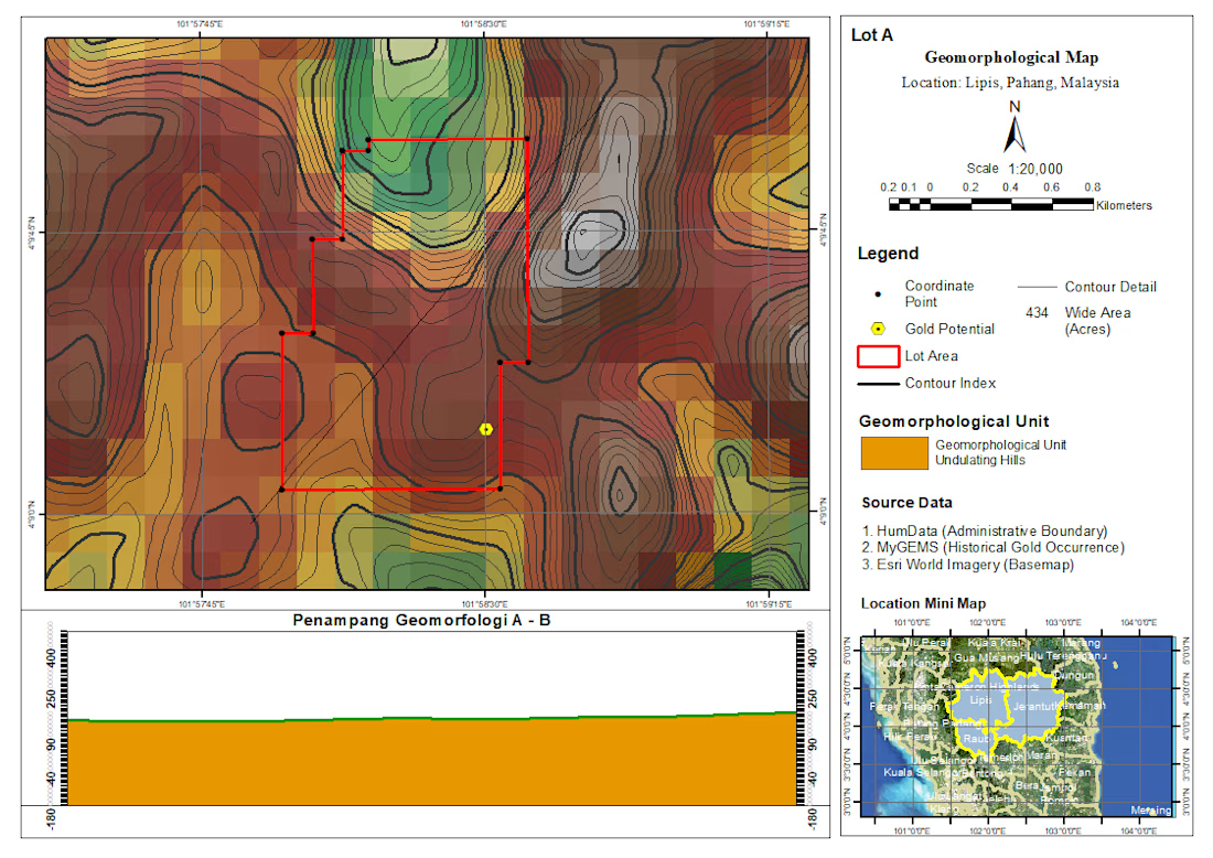
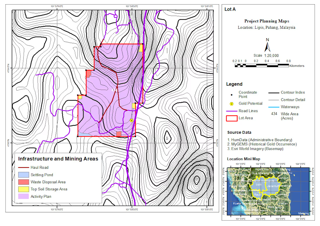
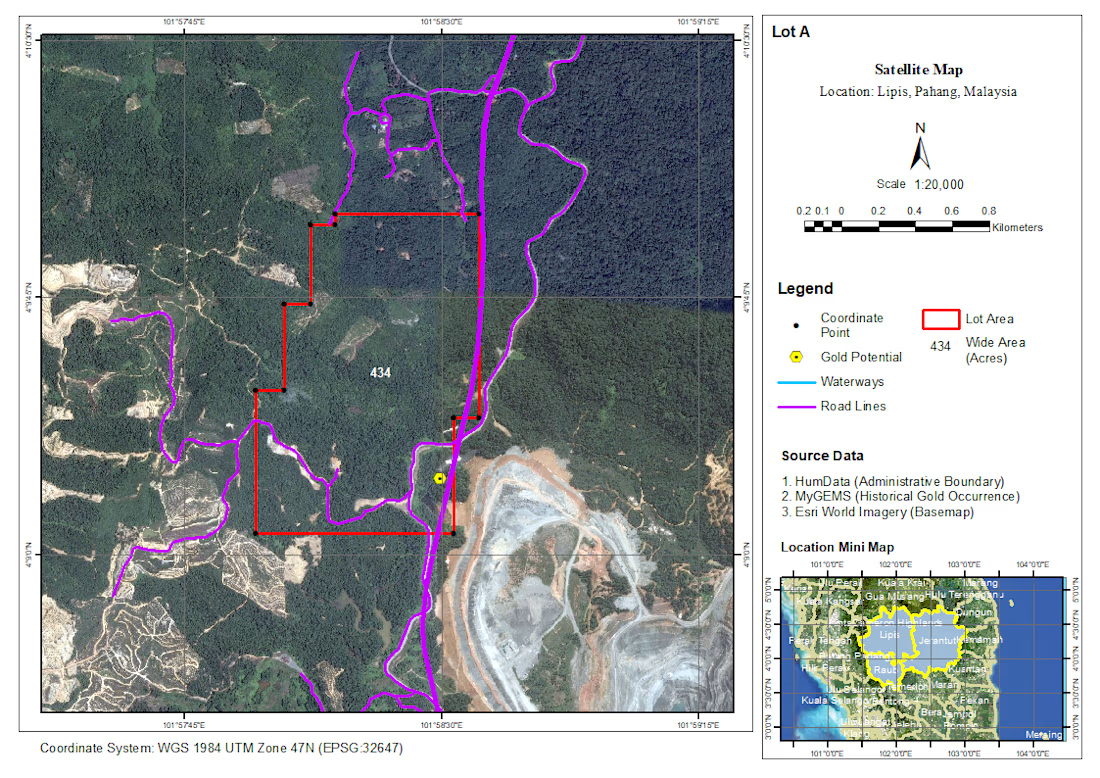
Recently completed a GIS-based desktop study for a gold exploration project in Pahang, Malaysia, covering areas around Lipis, Jerantut, and Raub.
As a GIS Analyst, I worked on compiling and integrating multiple spatial datasets to support preliminary assessment and planning of potential exploration areas.
The analysis and mapping included:
• Regional geological mapping
• Geomorphological analysis
• Satellite imagery interpretation
• Gold occurrence and resource visualization
• Accessibility and surrounding area analysis
• Quarry/resource mapping
• Project planning and infrastructure mapping
• Permit application mapping
The workflow involved combining geological and mineral occurrence data with terrain, satellite imagery, road networks, waterways, and project boundaries to create clear and structured thematic maps for desktop-level assessment.
The maps were developed using ArcGIS with a focus on consistent cartographic standards, spatial accuracy, and presenting complex geospatial information in a format that can support further exploration planning and decision-making.
This project was a great opportunity to apply GIS not only for visualization, but also as a tool for integrating geological, environmental, and spatial information into a more structured exploration workflow.
📍 Pahang, Malaysia
🗺️ GIS Analysis & Cartography
⛏️ Gold Exploration Desktop Study


The network for creativity
Join 1.25M professional creatives like you
Connect with clients, get discovered, and run your business 100% commission-free
Creatives on Contra have earned over $150M and we are just getting started







Related posts

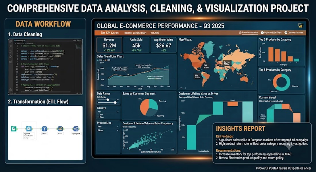
Welcome! Are you looking to turn messy data into clear, actionable insights? You're in the right place.
As a professional data analyst, I specialize in transforming raw data into clean, structured, and visually compelling dashboards that help businesses make smarter decisions.
What I Offer:
• Data Cleaning & Preparation (Handling missing values, removing duplicates, formatting)
• Exploratory Data Analysis (EDA) to find key trends and patterns
• Interactive Dashboards & Reports (Power BI/ Excel)
• Custom DAX / SQL queries for deep metric tracking
• Professional summary report with key business insights
Tools I Use:
• Power BI
• Python & SQL
• Advanced Excel & Google Sheets
Why Choose Me?
• High-quality, clean design with user-friendly layouts
• Fast turnaround time and clear communication
• 100% satisfaction guarantee
Let's unlock the story behind your data! Please contact me before placing an order so we can discuss your specific project goals.


Editorial and Branding Studies inspired by my recent visit to Mt. Rainier National Park. Full project on my website!



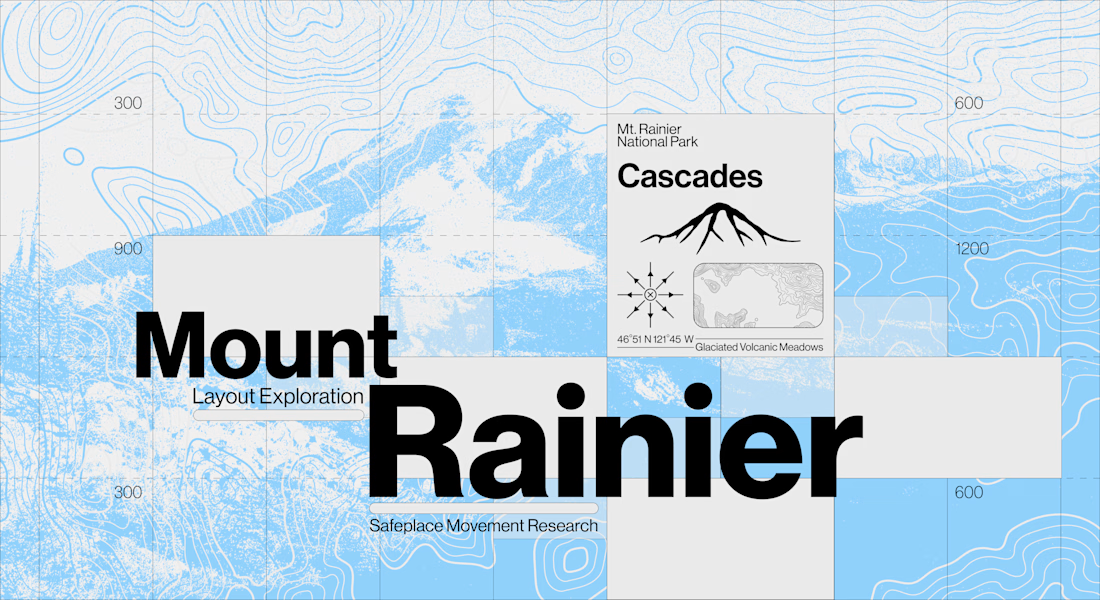

Nobody briefs the constraints out of a self-initiated study, which is usually why this kind of work is what gets someone hired for the paid version. The topographic layer is carrying the place so completely that the grotesk on top gets to stay neutral — a clean division of...

"Businesses lose time and money to invoice errors that go unnoticed until it's too late. I built an automated pipeline that extracts invoice data, cross-checks it against vendor history, and flags anomalies with clear AI-generated reasoning — all visualized in a real-time dashboard. Stack: LangChain, Groq, n8n, FastAPI, Next.js."


