The network for creativity
Join 1.25M professional creatives like you
Connect with clients, get discovered, and run your business 100% commission-free
Creatives on Contra have earned over $150M and we are just getting started
Back to feedPost
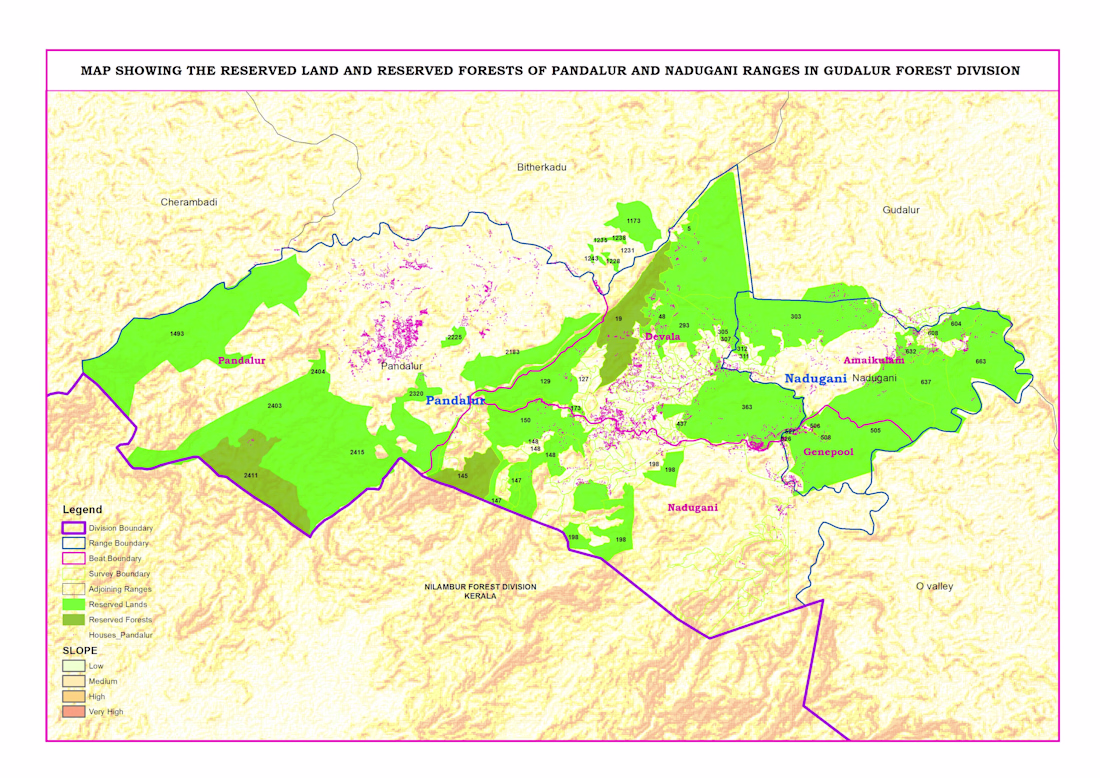
Reserved Land & Reserved Forest Map – Pandalur & Nadugani Ranges
This project focuses on mapping reserved lands and reserved forests in the Pandalur and Nadugani ranges under the Gudalur Forest Division.
Using QGIS, I created a detailed administrative map including division, range, beat, and survey boundaries. I integrated forest classification data with terrain (slope) analysis to provide a clear understanding of land distribution and landscape characteristics.
The map also highlights human settlements within and around forest areas, helping in planning, management, and decision-making.
This project demonstrates my expertise in administrative mapping, boundary digitization, and geospatial data visualization for government and environmental applications.
👉 Available for administrative mapping and GIS projects. Feel free to message me.
The network for creativity
Join 1.25M professional creatives like you
Connect with clients, get discovered, and run your business 100% commission-free
Creatives on Contra have earned over $150M and we are just getting started
Related posts
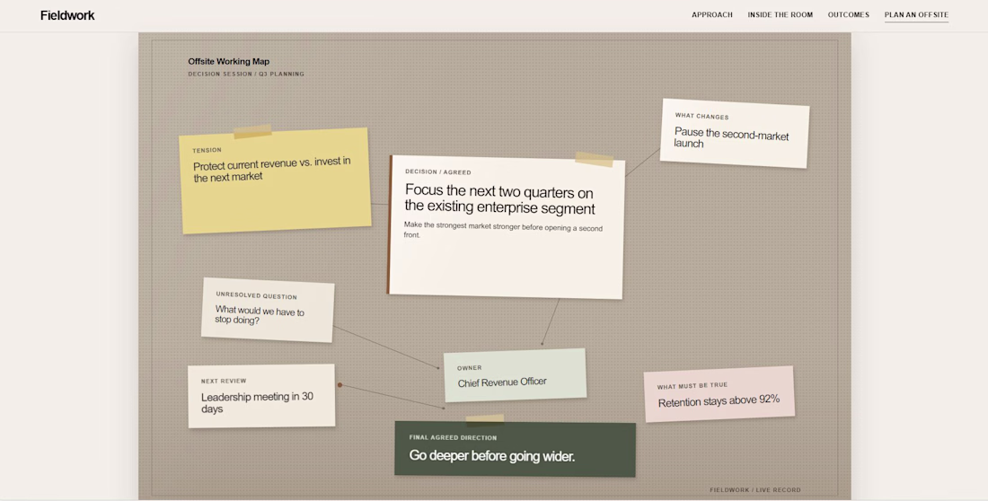
Many service websites list a process, but the buyer still cannot picture the work.
For Fieldwork, I used a working map that shows the tension, decision, owner, and next review.
One concrete artifact makes the service easier to trust.
Great work
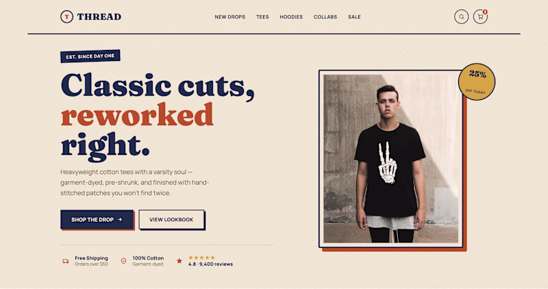
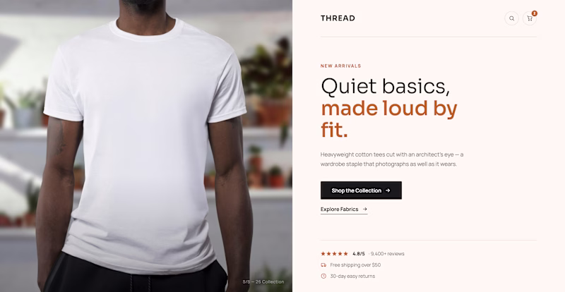
Two heroes. Same tee brand. Opposite personality.
Retro Varsity shouts. Bold serif, graphic tee, warm cream and navy, badge in the corner.
Editorial whispers. Full-bleed crop, plain white tee, all negative space and quiet confidence.
One sells the print. One sells the fit.
Streetwear or staple, which look sells a tee harder?
🏈 Retro Varsity
🤍 Editorial
Vote below.
6 voted
100%
0 voted
0%
6 votes
Closed
The print vs fit framing is spot on. Retro sells energy, editorial sells product quality. For a tee brand I would probably lean editorial on PDP and keep retro for campaign landings.
This motion explores the visual identity of SOLA a modern learning platform built to make skill-building simple, structured, and enjoyable. Through clean transitions, bold typography, and a vibrant color system, the animation brings the brand to life while reflecting growth, curiosity, and continuous learning.
Every movement is designed to reinforce SOLA's approachable and confident personality, turning a static identity into an engaging brand experience.
The motion design for SOLA is so smooth and confident, Afifudin! It perfectly captures that vibrant energy. 🚀✨
Trending
Claude
Claude has entered the design space. How are you using Claude Design?
Contra University
Learn from expert creatives how to earn more using next-gen AI tools.
creativeaiflow
Creative AI workflows are evolving. What tools do you use, and what are their strengths and weaknesses?
freelancerlife
Freelancer life is wins, pivots, and everything in between. What’s yours right now?