
You will get an expert QGIS analysis for planning and monitoringRafi Mahmud
I provide professional GIS services for urban planning, environmental monitoring, and spatial data management. I help planners, researchers, and organizations analyze geographic data to make better decisions. From land use analysis to environmental impact assessments, I handle complex spatial tasks and deliver clear, actionable results with professional maps and reports.
I specialize in urban growth analysis, zoning maps, site suitability studies, and infrastructure planning. For environmental projects, I do vegetation monitoring, watershed analysis, pollution mapping, and change detection using satellite imagery. I also clean messy GIS databases, fix geometry errors, remove duplicates, standardize attributes, and perform quality checks on spatial data. All analysis includes statistical reports and presentation-ready maps.
You receive cleaned datasets, professional maps in multiple formats and detailed analysis reports. All project files are organized with proper symbology and labeling. Maps follow industry standards and can be customized for reports, presentations, or web display
What's included
Maps
I will provide maps according to your want
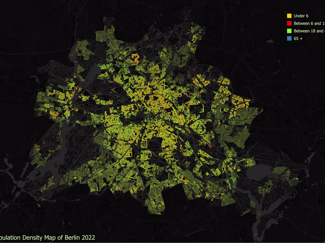
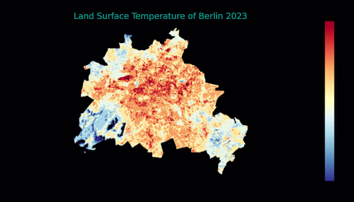
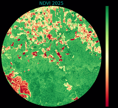
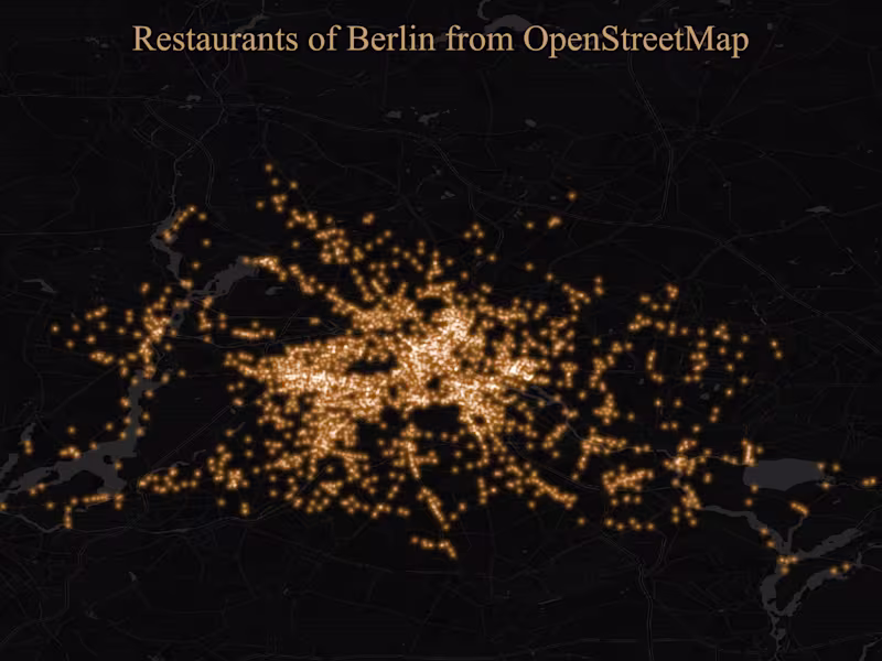
Example work
Rafi's other services
Starting at$10
Duration3 days
Tags
Matplotlib
Python
QGIS
Data Analyst
Data Scientist
Data Visualizer
Service provided by
Rafi Mahmud Berlin, Germany
You will get an expert QGIS analysis for planning and monitoringRafi Mahmud
Starting at$10
Duration3 days
Tags
Matplotlib
Python
QGIS
Data Analyst
Data Scientist
Data Visualizer
I provide professional GIS services for urban planning, environmental monitoring, and spatial data management. I help planners, researchers, and organizations analyze geographic data to make better decisions. From land use analysis to environmental impact assessments, I handle complex spatial tasks and deliver clear, actionable results with professional maps and reports.
I specialize in urban growth analysis, zoning maps, site suitability studies, and infrastructure planning. For environmental projects, I do vegetation monitoring, watershed analysis, pollution mapping, and change detection using satellite imagery. I also clean messy GIS databases, fix geometry errors, remove duplicates, standardize attributes, and perform quality checks on spatial data. All analysis includes statistical reports and presentation-ready maps.
You receive cleaned datasets, professional maps in multiple formats and detailed analysis reports. All project files are organized with proper symbology and labeling. Maps follow industry standards and can be customized for reports, presentations, or web display
What's included
Maps
I will provide maps according to your want
Example work
Rafi's other services
$10