
Data-driven Maps and VisualizationsJacob Kohn
Offering services in GIS, data visualization, and graphic design to create compelling maps and visualizations that communicate data-driven stories about our world.
What's included
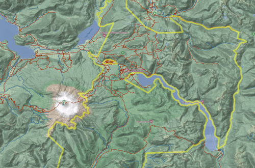
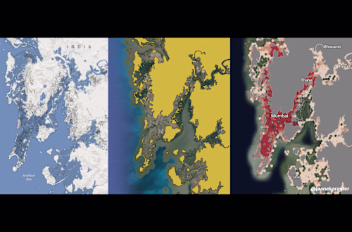
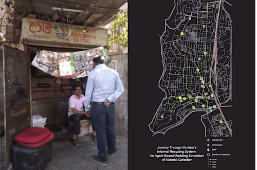
Static Maps
A high-resolution map of your intended theme or geographic location.
Interactive Maps
A map that can be panned, scrolled, zoomed, and clicked in order to show the information you need.
Example work


Contact for pricing
Tags
Microsoft Excel
Python
QGIS
R
Tableau
Data Visualizer
Graphic Designer
Service provided by
Jacob Kohn Washington, USA
Data-driven Maps and VisualizationsJacob Kohn
Contact for pricing
Tags
Microsoft Excel
Python
QGIS
R
Tableau
Data Visualizer
Graphic Designer
Offering services in GIS, data visualization, and graphic design to create compelling maps and visualizations that communicate data-driven stories about our world.
What's included
Static Maps
A high-resolution map of your intended theme or geographic location.
Interactive Maps
A map that can be panned, scrolled, zoomed, and clicked in order to show the information you need.
Example work
Contact for pricing