
Photogrammetry & 3D Reconstruction3d WebGL
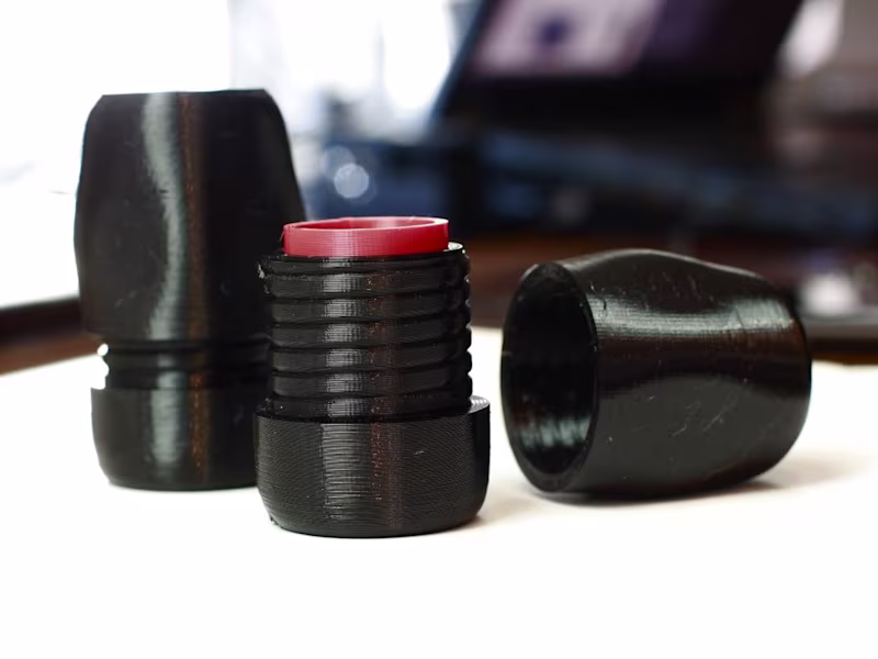
I create accurate 3D reconstructions from photogrammetry, drone imagery, 3D scans, or photos/video, delivering high-resolution models optimized for visualization, simulation, or prototyping. Models are cleaned, retopologized, and prepared for real-time use, printing, or interactive applications. This service is ideal for designers, engineers, GIS specialists, and researchers needing precise, production-ready 3D assets.
What's included
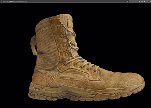
3D reconstruction from images or scans
Accurate 3D models generated from photogrammetry, drone imagery, 3D scans, or video/photo material,
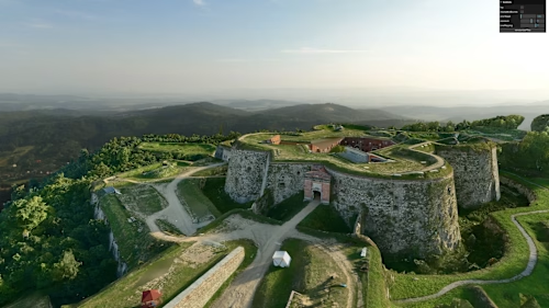
Handles objects, environments, terrain, and complex surfaces,
Produces high-resolution meshes suitable for visualization, simulation, or prototyping,
Cleaned and optimized 3D models
Mesh cleaning, retopology, and decimation for performance-friendly 3D models,
UV mapping and texture optimization for real-time use (WebGL, Three.js) or offline rendering,
Optional high-detail textures including albedo, roughness, and normal maps,
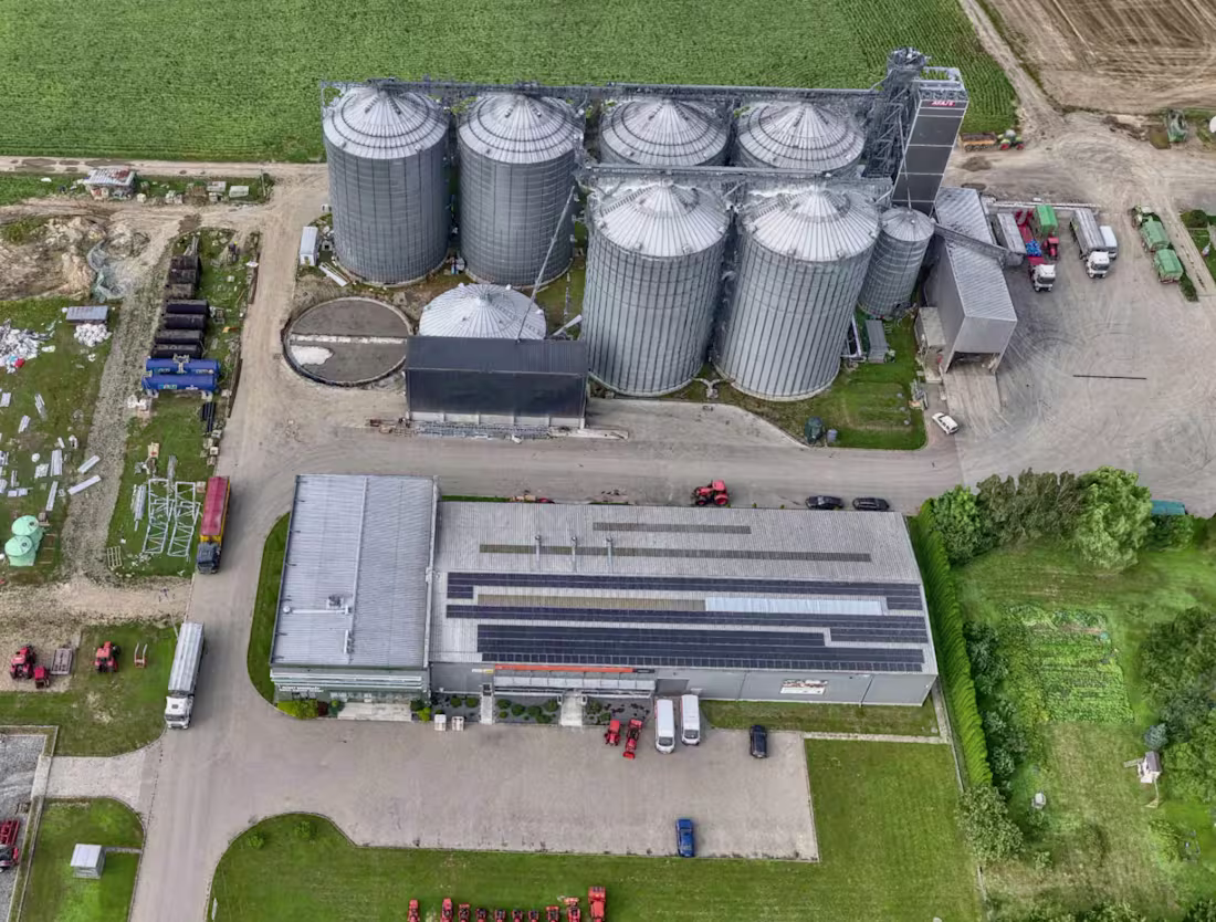
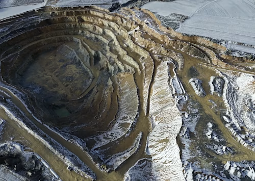
Geographic / large-scale reconstruction
Supports terrain mapping, GIS-based projects, and large-area reconstructions,
Optimized for accurate georeferencing, scale, and multi-source integration,
Interactive or delivery-ready outputs
WebGL-ready models for interactive viewing and presentation,
STL, OBJ, or other formats for printing, simulation, or further processing,
Optional standalone interactive 3D applications for client demonstration,
Optional add-ons
Multi-resolution models for level-of-detail workflows,
Parametric adaptation for modular assets or variants,
Integration with animation, AR/VR, or simulation pipelines,
Example work
Contact for pricing
Tags
Agisoft Metashape
Blender
QGIS
3D Designer
3D Modeler
Photographer
Service provided by
3d WebGL Wrocław, Poland
- 8
- Followers
Photogrammetry & 3D Reconstruction3d WebGL
I create accurate 3D reconstructions from photogrammetry, drone imagery, 3D scans, or photos/video, delivering high-resolution models optimized for visualization, simulation, or prototyping. Models are cleaned, retopologized, and prepared for real-time use, printing, or interactive applications. This service is ideal for designers, engineers, GIS specialists, and researchers needing precise, production-ready 3D assets.
What's included
3D reconstruction from images or scans
Accurate 3D models generated from photogrammetry, drone imagery, 3D scans, or video/photo material,
Handles objects, environments, terrain, and complex surfaces,
Produces high-resolution meshes suitable for visualization, simulation, or prototyping,
Cleaned and optimized 3D models
Mesh cleaning, retopology, and decimation for performance-friendly 3D models,
UV mapping and texture optimization for real-time use (WebGL, Three.js) or offline rendering,
Optional high-detail textures including albedo, roughness, and normal maps,
Geographic / large-scale reconstruction
Supports terrain mapping, GIS-based projects, and large-area reconstructions,
Optimized for accurate georeferencing, scale, and multi-source integration,
Interactive or delivery-ready outputs
WebGL-ready models for interactive viewing and presentation,
STL, OBJ, or other formats for printing, simulation, or further processing,
Optional standalone interactive 3D applications for client demonstration,
Optional add-ons
Multi-resolution models for level-of-detail workflows,
Parametric adaptation for modular assets or variants,
Integration with animation, AR/VR, or simulation pipelines,
Example work
Contact for pricing