
I will do process Satellite Data and do Spatial Analysis.Rohma Shakoor
Satellite Image Analysis & NDVI Vegetation Monitoring
Are you looking to monitor vegetation health, analyse land cover, or understand environmental changes using satellite imagery?
I provide GIS and Remote Sensing services using Google Earth Engine and geospatial tools to transform satellite data into meaningful spatial information.
What I offer:
NDVI vegetation health analysis
NDWI water body analysis
NDBI built-up area analysis
Sentinel-2 and Landsat satellite image processing
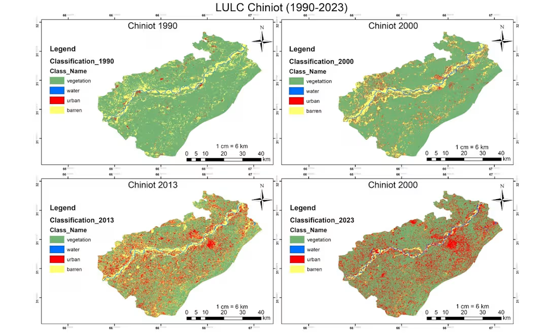
Land Use/Land Cover (LULC) mapping
Multi-temporal vegetation monitoring
Change detection and spatial analysis
GIS map production and visualization
Deliverables:
Processed satellite imagery
NDVI or other requested index maps
High-resolution PNG/PDF maps
GIS-ready GeoTIFF outputs (where applicable)
Brief analysis report with key findings
My workflow:
Understand your study area and objectives.
Select suitable satellite imagery.
Process and analyse the satellite data.
Generate thematic maps and outputs.
Deliver the final results.
Tools: Google Earth Engine, ArcGIS, QGIS and Python.
Please contact me before ordering so we can discuss your study area, data requirements and expected deliverables.

Starting at$30
Duration3 days
Tags
ArcGIS

Python

QGIS

Data Analyst
data processing
Web Developer
Google earth engine
Spatial Analysis
web gis
Service provided by
Rohma Shakoor Lahore, Pakistan
- 2
- Followers
I will do process Satellite Data and do Spatial Analysis.Rohma Shakoor
Starting at$30
Duration3 days
Tags
ArcGIS
Python
QGIS
Data Analyst
data processing
Web Developer
Google earth engine
Spatial Analysis
web gis
Satellite Image Analysis & NDVI Vegetation Monitoring
Are you looking to monitor vegetation health, analyse land cover, or understand environmental changes using satellite imagery?
I provide GIS and Remote Sensing services using Google Earth Engine and geospatial tools to transform satellite data into meaningful spatial information.
What I offer:
NDVI vegetation health analysis
NDWI water body analysis
NDBI built-up area analysis
Sentinel-2 and Landsat satellite image processing
Land Use/Land Cover (LULC) mapping
Multi-temporal vegetation monitoring
Change detection and spatial analysis
GIS map production and visualization
Deliverables:
Processed satellite imagery
NDVI or other requested index maps
High-resolution PNG/PDF maps
GIS-ready GeoTIFF outputs (where applicable)
Brief analysis report with key findings
My workflow:
Understand your study area and objectives.
Select suitable satellite imagery.
Process and analyse the satellite data.
Generate thematic maps and outputs.
Deliver the final results.
Tools: Google Earth Engine, ArcGIS, QGIS and Python.
Please contact me before ordering so we can discuss your study area, data requirements and expected deliverables.
$30