
GIS Development : Geospatial, Mapping, Interactive GIS AppsPavel Nefir
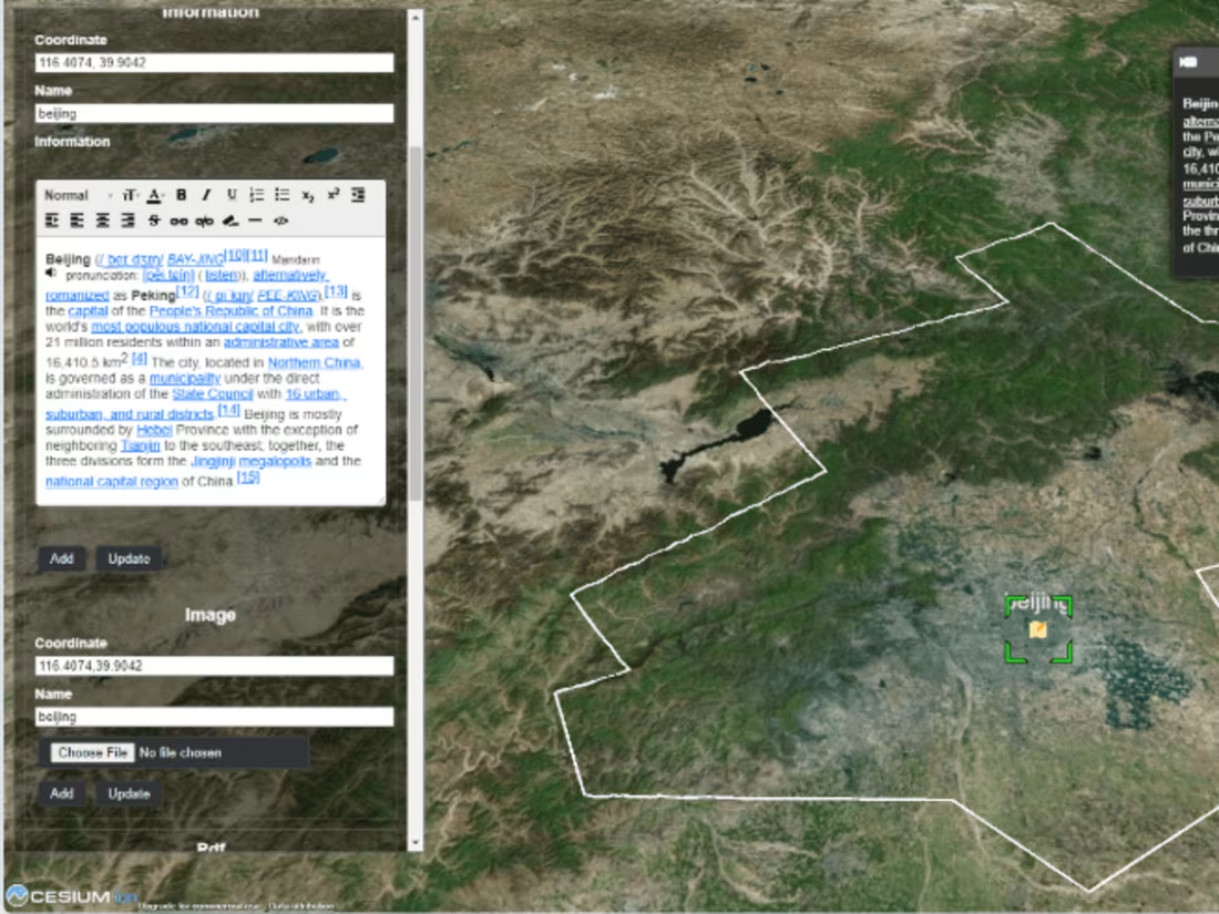
As a GIS Developer, I specialize in building high-performance geospatial applications that enable data-driven decision-making. I offer custom GIS solutions, including interactive web maps, spatial analysis tools, and geoprocessing automation using modern technologies like Leaflet, Mapbox, OpenLayers, and Python GIS libraries. What makes me unique is my ability to optimize GIS performance for large-scale datasets, integrate GIS with real-time data streams and APIs, and create user-friendly spatial tools tailored to business needs.
What's included
GIS Applications & Web Maps
- Interactive web maps (Leaflet, Mapbox, OpenLayers, ArcGIS API)
- Custom GIS web applications (React, Node.js, Python/Django, etc.)
- Mobile GIS applications (Android/iOS)
Geospatial Analysis & Reports
- Spatial analysis (buffering, clustering, spatial joins)
- Terrain modeling (DEM, slope, aspect analysis)
- Suitability analysis and decision-making models
- PDF/HTML reports with maps, charts, and analysis summaries
API & Integrations
- GIS API development for spatial data access
- Integration with Google Maps, OpenStreetMap, ArcGIS, etc.
- REST/GraphQL APIs for geospatial data
GIS Data & Databases
- Processed and cleaned geospatial datasets
- Spatial databases (PostGIS, MongoDB, etc.)
- Data conversion (e.g., Shapefiles to GeoJSON, KML, or CSV)
- Georeferenced raster and vector layers


Contact for pricing
Tags
Leaflet
Mapbox
Openlayers
QGIS
Frontend Engineer
Fullstack Engineer
Software Engineer
Service provided by
Pavel Nefir proBucharest, Romania
- $1k+
- Earned
- 3
- Paid projects
- 5.00
- Rating
- 19
- Followers
GIS Development : Geospatial, Mapping, Interactive GIS AppsPavel Nefir
Contact for pricing
Tags
Leaflet
Mapbox
Openlayers
QGIS
Frontend Engineer
Fullstack Engineer
Software Engineer
As a GIS Developer, I specialize in building high-performance geospatial applications that enable data-driven decision-making. I offer custom GIS solutions, including interactive web maps, spatial analysis tools, and geoprocessing automation using modern technologies like Leaflet, Mapbox, OpenLayers, and Python GIS libraries. What makes me unique is my ability to optimize GIS performance for large-scale datasets, integrate GIS with real-time data streams and APIs, and create user-friendly spatial tools tailored to business needs.
What's included
GIS Applications & Web Maps
- Interactive web maps (Leaflet, Mapbox, OpenLayers, ArcGIS API)
- Custom GIS web applications (React, Node.js, Python/Django, etc.)
- Mobile GIS applications (Android/iOS)
Geospatial Analysis & Reports
- Spatial analysis (buffering, clustering, spatial joins)
- Terrain modeling (DEM, slope, aspect analysis)
- Suitability analysis and decision-making models
- PDF/HTML reports with maps, charts, and analysis summaries
API & Integrations
- GIS API development for spatial data access
- Integration with Google Maps, OpenStreetMap, ArcGIS, etc.
- REST/GraphQL APIs for geospatial data
GIS Data & Databases
- Processed and cleaned geospatial datasets
- Spatial databases (PostGIS, MongoDB, etc.)
- Data conversion (e.g., Shapefiles to GeoJSON, KML, or CSV)
- Georeferenced raster and vector layers
Contact for pricing