
Interactive Web GIS Map with Leaflet and GeoJSONKevin Ilham
Turn your geospatial data into one interactive Leaflet map page for an existing website or application.
Included
• Up to three client-provided GeoJSON layers, 2,000 features and 20 MB total.
• Layer controls, legend, feature popups and one attribute filter.
• Responsive page layout and integration with the agreed existing app.
• Source code, data-format notes, setup instructions and one scoped revision.
Delivery: 7 days after the data, target map view and integration access are ready.
Please provide your GeoJSON files, field descriptions, required popup content and preferred map extent. We will agree on the expected interactions before starting.
The price covers map implementation using the data you supply. Surveys, data collection, georeferencing, complex spatial analysis, vector-tile pipelines, a new backend, login system and extra modules require a separate scope. Hosting and commercial map-tile costs are paid by the client.
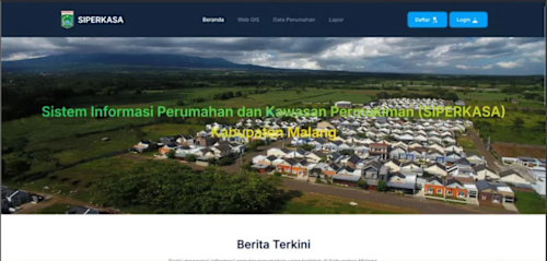
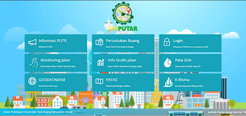
My background includes government information systems, housing and infrastructure maps, permit workflows and field-monitoring applications. Message me with your dataset and intended map behaviour before ordering.
FAQs
Example work


Starting at$270
Duration7 days
Tags
JavaScript

Web Developer
Service provided by
Kevin Ilham Surabaya, Indonesia
Interactive Web GIS Map with Leaflet and GeoJSONKevin Ilham
Starting at$270
Duration7 days
Tags
JavaScript
Web Developer
Turn your geospatial data into one interactive Leaflet map page for an existing website or application.
Included
• Up to three client-provided GeoJSON layers, 2,000 features and 20 MB total.
• Layer controls, legend, feature popups and one attribute filter.
• Responsive page layout and integration with the agreed existing app.
• Source code, data-format notes, setup instructions and one scoped revision.
Delivery: 7 days after the data, target map view and integration access are ready.
Please provide your GeoJSON files, field descriptions, required popup content and preferred map extent. We will agree on the expected interactions before starting.
The price covers map implementation using the data you supply. Surveys, data collection, georeferencing, complex spatial analysis, vector-tile pipelines, a new backend, login system and extra modules require a separate scope. Hosting and commercial map-tile costs are paid by the client.
My background includes government information systems, housing and infrastructure maps, permit workflows and field-monitoring applications. Message me with your dataset and intended map behaviour before ordering.
FAQs
Example work
$270