
Georeferencing, Digitization, Spatial AnalysisDamilare Ogunajo
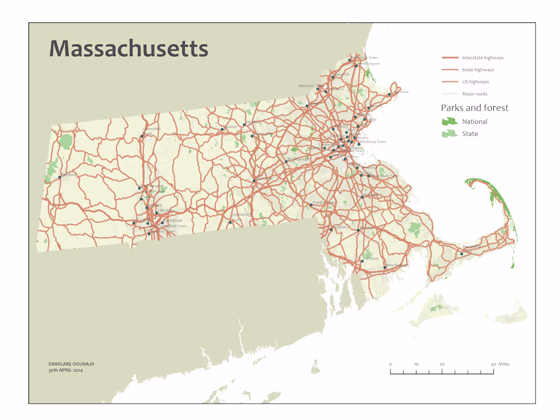
This service provides expert geospatial solutions, including georeferencing, digitization, and spatial analysis using Geographic Information Systems (GIS).I offer precise transformation of map coordinates to a defined coordinate reference system (CRS), digitize spatial data, and conduct in-depth spatial analysis, including Land Use Land Cover (LULC) classification, overlay analysis, and spatial pattern recognition.
What's included
Georeferencing
Relate custom coordinate systems of digital maps or aerial photos to a ground system of geographic coordinates, ensuring precise spatial alignment for your projects.
Digitization
Convert geographic features from paper maps into digital format, enabling easy manipulation, analysis, and integration with other digital data sources.
Geospatial Analysis
Perform essential geospatial analysis tasks, including spatial data visualization, spatial statistics, overlay operations, and Land Use Land Cover (LULC) Analysis to assess and categorize the landscape. These analyses provide valuable insights for environmental planning, urban development, and resource management.
Damilare's other services

Contact for pricing
Tags
Microsoft Excel
QGIS
Data Analyst
Data Scientist
Data Visualizer
Service provided by
Damilare Ogunajo Lagos, Nigeria
Georeferencing, Digitization, Spatial AnalysisDamilare Ogunajo
Contact for pricing
Tags
Microsoft Excel
QGIS
Data Analyst
Data Scientist
Data Visualizer
This service provides expert geospatial solutions, including georeferencing, digitization, and spatial analysis using Geographic Information Systems (GIS).I offer precise transformation of map coordinates to a defined coordinate reference system (CRS), digitize spatial data, and conduct in-depth spatial analysis, including Land Use Land Cover (LULC) classification, overlay analysis, and spatial pattern recognition.
What's included
Georeferencing
Relate custom coordinate systems of digital maps or aerial photos to a ground system of geographic coordinates, ensuring precise spatial alignment for your projects.
Digitization
Convert geographic features from paper maps into digital format, enabling easy manipulation, analysis, and integration with other digital data sources.
Geospatial Analysis
Perform essential geospatial analysis tasks, including spatial data visualization, spatial statistics, overlay operations, and Land Use Land Cover (LULC) Analysis to assess and categorize the landscape. These analyses provide valuable insights for environmental planning, urban development, and resource management.
Damilare's other services
Contact for pricing