
Georeferencng of satellite image and cadastralMANJU LATA
GIS professional with a master's degree in GIS and Remote Sensing. Bringing over a decade of experience in data analysis, monitoring, land use, and cover mapping to ensure exceptional quality work for client satisfaction.Professional GIS engineer with a master's in GIS and Remote Sensing. Offering 15 years of expertise in handling GIS-based projects, ensuring top-notch quality and client satisfaction as my priority.Experienced Data Engineer and Video Editor. Master's degree in GIS and Remote Sensing. Specialize in GIS-based projects with 15 years of expertise. Committed to delivering.
What's included
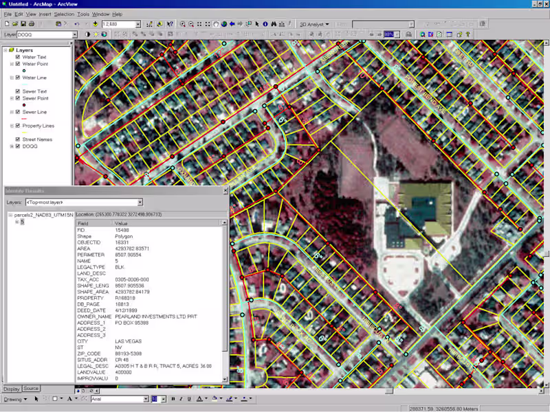
Map with GIS Data
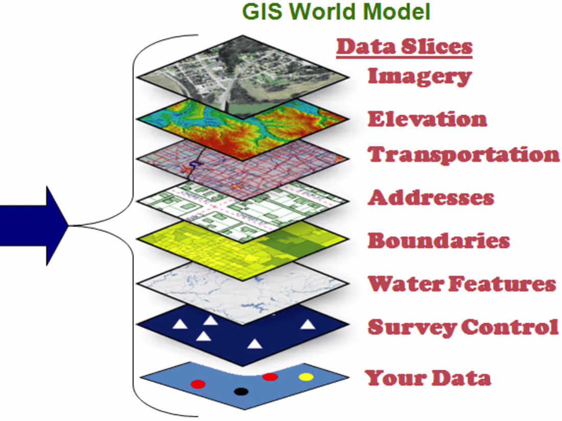
.Rectification/Geo-Referecing Of Satellie Image and cadastral map.
1. Satellite Image :- LISS III , Cartosat, LISS IV Any other satellite Image.
2. Cadastral Data In Both Format RASTER AND VECTOR.
3. TOPOSHEET.
MANJU's other services
Starting at$35 /hr
Tags
QGIS
Data Analyst
Data Modelling Analyst
Data Scientist
Service provided by
MANJU LATA Noida, India
Georeferencng of satellite image and cadastralMANJU LATA
GIS professional with a master's degree in GIS and Remote Sensing. Bringing over a decade of experience in data analysis, monitoring, land use, and cover mapping to ensure exceptional quality work for client satisfaction.Professional GIS engineer with a master's in GIS and Remote Sensing. Offering 15 years of expertise in handling GIS-based projects, ensuring top-notch quality and client satisfaction as my priority.Experienced Data Engineer and Video Editor. Master's degree in GIS and Remote Sensing. Specialize in GIS-based projects with 15 years of expertise. Committed to delivering.
What's included
Map with GIS Data
.Rectification/Geo-Referecing Of Satellie Image and cadastral map.
1. Satellite Image :- LISS III , Cartosat, LISS IV Any other satellite Image.
2. Cadastral Data In Both Format RASTER AND VECTOR.
3. TOPOSHEET.
MANJU's other services
$35 /hr