Projects using ArcGIS in Bandung
Projects using ArcGIS in Bandung
Sign Up
Post a job
Sign Up
Log In
Filters
2
Projects
People
Message
3
Andi Ramdani
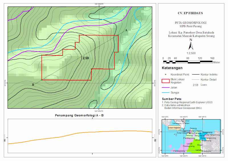
Professional Geomorphology Map & Terrain Profile (ArcGIS/QGIS) I create precise and visually clear geomorphological maps like this, including: - Contour mapping (index & detailed) - Landform interpretation - River and infrastructure overlay - Project boundary mapping - Elevation cross-section analysis (A–B profile) Perfect for research, environmental analysis, mining, or land development projects.
5
3
137
Explore projects